DSMGenerator

DSMGenerator

DSMGenerator

Automatic generation of Digital Surface Models

Product

Automatic generation of digital surface models from high resolution multi-stereoscopic acquisitions

Satellites / Instruments

Stereoscopic satellite products, such as Pleiades

U

Skills

Sensor geometry, multi-stereoscopy, multi-threading

Date

From 2018 to today

The ready-to-use product DSMGenerator


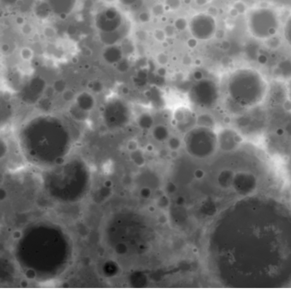
    DSMGenerator (Digital Surface Model Generator) is a tool for automatic generation of digital surface models from high-resolution multi-stereoscopic acquisitions. Acquisitions come from satellites such as Pleiades.

    The DSMGenerator tool is designed to make the most of parallel computing. Indeed, this is made possible by multithreading and careful management of memory consumption.

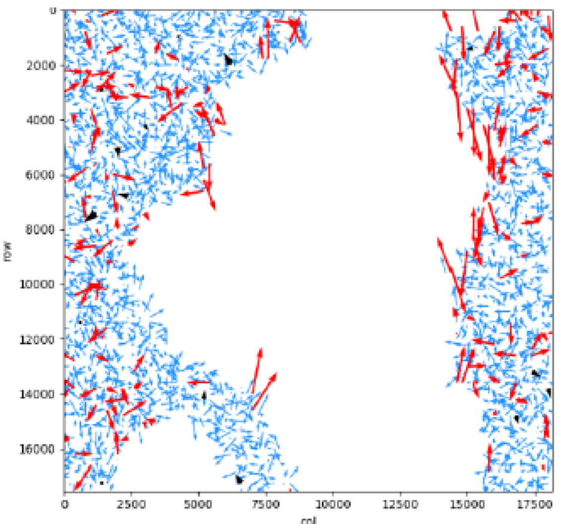
    Production follows defined steps. First, for each pair of images, we perform a projection in epipolar geometry using Euclidium and a cutting of the tiles. Then, for each pair of tiles, we perform a disparity map calculation using the OpenCV SGMB implementation. We also perform a conversion of the disparity map into a point cloud. Finally, we merge all the point clouds and produce the final DSM.

    dsm generator magellium

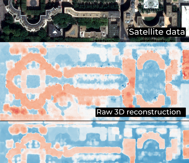
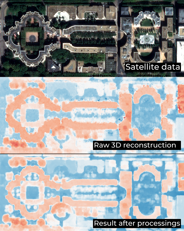
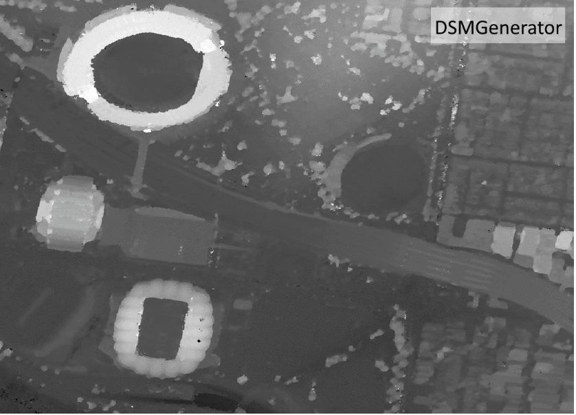
    Comparison of a DSM generated by DSMGenerator from a Pleiades stereo triplet and a DSM generated by other methods from the same inputs.

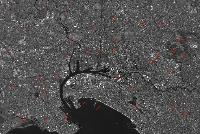
    The EO unit tested the product on Pleiades HR 3-stereo, Pleiades HR 13-stereo and ZY3-2-stereo. In conclusion, it took less than an hour to process the Pleiades HR 3-stereo data on a 12-core server.

    The DSMGenerator tool is also used for the 3D reconstruction.

    nous contacter observation terre magellium

    Product features


    Multi-sensor genericity

    Physical or rpc modelling of the line of sight

    Multi-stereo, from 2 to n-tuplet

    Production of intermediate clouds

    Production of a final 2.5D digital surface model at the resolution of the original image

    Parallel, scalable, cloud-ready computing

    Key words

    satellite, digital surface model, DSM, pleiade, geometry, point cloud, stereo

    observation de la terre

    SCIENCE FOR EARTH CARE

    The Earth Observation Unit of Magellium  is an expert in optical space missions and geophysical and biophysical applications. The EO unit provides high level of expertise and full capacity on the whole processing chain, enabling it to respond to all projects from the greatest space orders such as ESA and CNES.

    Contact

    eo@magellium.fr

    +33 5 62 24 70 00

    1, rue Ariane
    31520 Ramonville Saint-Agne FRANCE

    More info

    www.magellium.com

    Follow us

    3D reconstruction

    3D reconstruction

    3D reconstruction

    3D reconstruction of urban areas

    Mission

    Conduct a series of studies to build a 3D representation of urban areas

    Instruments

    Pleiades

    U

    Skills

    Sensor geometry, deep learning, 3D reconstruction

    Date

    From 2020 to today

    The 3D reconstruction project


    Thanks to CNES contracts and our own investments, we are conducting a series of studies to build a 3D representation of urban areas. These 3D reconstructions are based on multi-stereo images such as Pleiades (50cm spatial resolution).

    3d reconstruction magellium pleiades

    The phases of a 3D reconstruction


    • 3D reconstruction of the DSM from multi-stereo images (by stereo-correlation)


    • MNS improvement (by deep learning)


    • detection of building footprints (deep learning)


    • segmentation of roof slopes (deep learning)


    • construction of LOD2 building models
    digital surface monitoring observation terre donnees satellite

    Key partner

    CNES

    Key words

    digital surface modelling, DSM, deep learning, Pleiades, sensor geometry, reconstruction, 3D, images, multi-stereo, areas, urban

    observation de la terre

    SCIENCE FOR EARTH CARE

    The Earth Observation Unit of Magellium  is an expert in optical space missions and geophysical and biophysical applications. The EO unit provides high level of expertise and full capacity on the whole processing chain, enabling it to respond to all projects from the greatest space orders such as ESA and CNES.

    Contact

    eo@magellium.fr

    +33 5 62 24 70 00

    1, rue Ariane
    31520 Ramonville Saint-Agne FRANCE

    More info

    www.magellium.com

    Follow us

    Lunar DEM

    Lunar DEM

    Lunar DEM

    3D reconstruction of the lunar surface by stereo-restitution

    Mission

    Reconstruction 3D de la surface lunaire

    Instruments

    Sonde Lunar Reconnaissance Orbiter (LRO)

    U

    Compétences

    Reconstruction 3D, géométrie, modélisation numérique de surface

    Date

    De 2020 à aujourd’hui

    The Lunar DEM project


    This project is part of a study for Airbus Defense & Space.

    The objective of this project is to calculate the most detailed Digital Surface Model (DSM) possible. This DSM is calculated from the images of the Narrow Angle Scanning (NAC) cameras of the Lunar Reconnaissance Orbiter (LRO).

    LRO is a NASA robotic spacecraft. Launched in 2009, it is part of the US Vision for Space Exploration programme. The data received by this spacecraft is characterised as being essential for “planning NASA’s future human and robotic missions to the Moon”.

    More about LRO here.

    nous contacter observation terre magellium

    The LUNAR DEM objectives


        • Prototyping of a processing chain performing the optimisation of the geometric model of the cameras

        • Stereo-restitution of the lunar surface and optimisation by the shape-from-shading algorithm
    lunar dem lune magellium airbus

    Key partner

    CNES

    Key words

    observation, satellite, Moon, studies, DSM, MNS, geometry, sensor, reconstruction, 3D, NASA

    observation de la terre

    SCIENCE FOR EARTH CARE

    The Earth Observation Unit of Magellium  is an expert in optical space missions and geophysical and biophysical applications. The EO unit provides high level of expertise and full capacity on the whole processing chain, enabling it to respond to all projects from the greatest space orders such as ESA and CNES.

    Contact

    eo@magellium.fr

    +33 5 62 24 70 00

    1, rue Ariane
    31520 Ramonville Saint-Agne FRANCE

    More info

    www.magellium.com

    Follow us

    LibGEO

    LibGEO

    LibGEO

    Library for Expert and Operational Geometry

    libgeo cnes magellium observation terre

    Product

    Geometric modelling library for Earth observation sensors

    Satellites / Instruments

    Pleiades, Pleiades NEO, Sentinel-2 L1B, CO3D, TRISHNA, 3MI, METImage, Metop SG, MicroCarb

    U

    Skills

    Geometry, in-orbit calibration, prototyping, study, geometric correction

    Date

    From 1995 to today

    The LibGEO product


    LibGEO is the new reference multi-sensor geometric modelling library of CNES (Centre National d’Etudes Spatiales). It is designed for the rigorous geometric modelling of Earth observation sensors. Indeed, this modelling allows to build a line of sight and to intersect with an Earth model (ellipsoid, Digital Elevation Model, geoid…). In addition, LibGEO provides a large number of tools to exploit and improve the geolocation of satellite images.

    This library is the result of more than 20 years of continuous improvement and R&D. This product was designed in collaboration with CNES and IGN (French National Geographic Institute).

    This product supports several sensors:

        • Pleiades and Pleiades NEO
        • Sentinel-2 L1B
        • CO3D
        • TRISHNA
        • 3MI, METImage, Metop SG
        • MicroCarb
        • Generic sensors, other sensors can be easily supported regardless of their nature (push-broom, frame camera, whiskbroom…)
    libgeo cnes magellium

    Residuals of the junction points, after refining the geometric parameters. Red arrows have been marked as anomalies and filtered out, while blue arrows are correct.

    The Earth Observation Unit is responsible for developing and editing the software on behalf of the CNES. Beyond modelling, LibGEO allows for the optimisation of physical parameters in order to improve localisation based on exogenous observations, generally obtained by a correlator or ground control points.

    nous contacter observation terre magellium

    The properties of LibGEO


      Les features :

          • Rigorous line of sight modelling

          • RPC and grid modelling

          • Direct (image>ground) and inverse (ground>image) localisation and collocation (image1>image2), intersection on digital elevation models

          • Grid resampling between geometries (image, ground, epipolar)

          • Optimisation of acquisition parameters (attitude, ephemeris…) using Ground Control Points and image correlation to improve geolocation

          • Outlier filtering

          • Geometry for stereo reconstruction

          • Serialization to disk of visualization models in XML format


      The services available :

          • Distribution, corrective, adaptive and evolutionary maintenance, support
          • Expertise & consulting and studies
          • Customised development: new sensors, geometric correction chain, dedicated tools, etc.

      The architecture :

          • Open, scalable, cloud-compatible C++ library
          • Extensive Python API, handy with tutorials
          • Available on Linux CentOs7, portable
      libgeo cnes magellium

      Optimisation of the visualisation model

      Key partners

      French Centre National d’Etudes Spatiales (CNES) and Institut Nation de l’Information Géographique et Forestière (IGN)

      Key words

      observation, satellite, earth, studies, LibGEO, library, modelling, geometry, sensor, CNES, software, finished product, Pleiades Neo, Sentinel, CO3D, Trishna, 3MI, METImage, Metop, MicroCarb, Euclidium, refinement, expertise, localisation, image

      observation de la terre

      SCIENCE FOR EARTH CARE

      The Earth Observation Unit of Magellium  is an expert in optical space missions and geophysical and biophysical applications. The EO unit provides high level of expertise and full capacity on the whole processing chain, enabling it to respond to all projects from the greatest space orders such as ESA and CNES.

      Contact

      eo@magellium.fr

      +33 5 62 24 70 00

      1, rue Ariane
      31520 Ramonville Saint-Agne FRANCE

      More info

      www.magellium.com

      Follow us

      Lunar DEM

      Lunar DEM

      Lunar DEM

      Reconstruction 3D de la surface lunaire par stéréo-restitution

      Mission

      Reconstruction 3D de la surface lunaire

      Instruments

      Sonde Lunar Reconnaissance Orbiter (LRO)

      U

      Compétences

      Reconstruction 3D, géométrie, modélisation numérique de surface

      Date

      De 2020 à aujourd’hui

      Le projet Lunar DEM


      Ce projet fait partie d’une étude pour le compte de Airbus Defense & Space.

      L’objectif de ce projet est de calculer le modèle numérique de surface (MNS) le plus détaillé possible. Ce MNS est calculé à partir des images des caméras à balai à angle étroit (NAC) de la sonde Lunar Reconnaissance Orbiter (LRO).

      LRO est un vaisseau spatial robotisé de la NASA. Lancé en 2009, il fait partie du programme Vision for Space Exploration des Etats-Unis. Les données receullies par ce vaisseau sont caractérisées comme étant essentielles pour la “planifaication des futures missions humaines et robotiques de la NASA sur la Lune”.

      En savoir plus sur LRO ici.

      nous contacter observation terre magellium

      Les objectifs de LUNAR DEM


      • Prototypage d’une chaîne de traitement réalisant l’optimisation du modèle géométrique des caméras


      • Stéréo-restitution de la surface lunaire et optimisation par l’algorithme shape-from-shading
      lunar dem lune magellium airbus

      Le partenaire principal

      CNES

      Mots-clés

      observation, satellite, Lune, études, DSM, MNS, géométrie, capteur, reconstruction, 3D, NASA

      observation de la terre

      SCIENCE FOR EARTH CARE

      L'unité Observation de la Terre de Magellium est experte en missions spatiales optiques et en applications géophysiques et biophysiques. L'unité offre un haut niveau d'expertise et une complète maîtrise sur l'ensemble de la chaîne de traitement, lui permettant de répondre à tous les projets des plus grandes commandes spatiales telles que l'ESA et le CNES.

      Contact

      eo@magellium.fr

      +33 5 62 24 70 00

      1, rue Ariane
      31520 Ramonville Saint-Agne FRANCE

      Plus d'infos

      www.magellium.com

      Suivez-nous