VENµS
Vegetation and Environment Monitoring on a New Micro-Satellite
Technical support to CNES


Mission
Close and regular monitoring of vegetation on the Earth’s surface in important selected areas
Instruments
Camera with 12 narrow spectral bands (420 to 910nm), native resolution of 5m
Skills
Radiometry, calibration, algorithmic corrections
Date
From 2003 to today
Launch date : 2017
The VENµS project
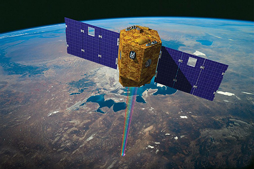
The VENµS satellite
The VENµS project is the result of cooperation between the French and Israeli agencies (CNES and ISA). It combines a scientific objective of monitoring vegetation with a technical objective of testing a new type of thruster (Hall effect).
VENµS is a research satellite containing two devices: an electric Hall effect thruster (managed by ISA) and a multispectral optical camera. VENµS provides images of 110 selected sites around the world: forests, crops, protected natural areas, etc. Since 2 August 2017, the satellite has been acquiring images in 12 spectral bands, using a camera provided by CNES. These images have a high spatial resolution (between 5 and 10 m on the ground with a field of view of 27 km) and a high temporal resolution (initially 2 days, reduced to 1 day following the lowering of the orbit). These characteristics set it apart from other satellites in operation and offer a revisit frequency and spatial finesse that are particularly well suited to the study of vegetation.
VENµS is particularly well suited to the study of vegetation. It allows us to understand and model the influence of environmental factors, human activities and climate change on continental surfaces.

Illustration of the VENµS satellite
© CNES/IDE./SARIAN Robin, 2015
The unit’s work
Magellium’s Earth Observation unit supported CNES on the mission preparatory studies and during the flight acceptance phase, working in particular on the radiometric correction algorithms of the processing chains and the performance study.
In November 2020, VENμS completed the first phase of its mission. This phase, called VM01, provided about 150 accurate time series at selected scientific sites over nearly three years. Extensive work was carried out to calibrate the camera and assess the quality of the products. Not everything worked as planned before the launch and a great deal of work was needed to correct certain defects in the camera or to improve the geometric registration of the images. It was especially during this VM1 phase that Magellium’s Earth Observation unit redoubled its efforts to ensure that the quality of the images was as high as possible.
Recently, an article on the characteristics of the VENµS mission appeared in the journal Remote Sensing and can be visited here.
For more information on the VENµS mission, visit the CNES website.
![]()
The objectives of VENµS
Part of the unit is based in the CNES buildings to better meet the needs of the project.
Our activity was mainly focused on:
-
-
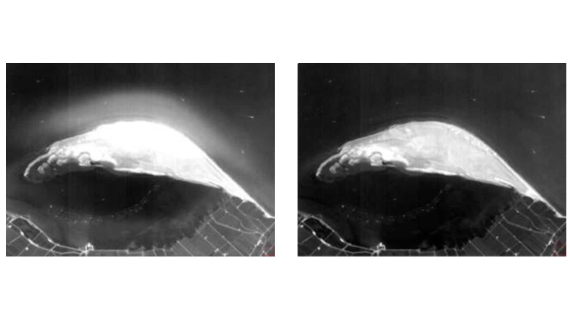
- Study and validation of a stray light correction algorithm
-
- Calibration of radiometric models (dark current, non-linearity)
-
- Estimation of cloud altitude by stereoscopy
-
- Estimation of the MTF (Modulation Transfer Function)
-

Stray light before and after correction
Key words
observation, earth, satellite, CNES, space agency, vegetation, study, science, biosphere, processing chain, climate, climate change
SCIENCE FOR EARTH CARE
The Earth Observation Unit of Magellium is an expert in optical space missions and geophysical and biophysical applications. The EO unit provides high level of expertise and full capacity on the whole processing chain, enabling it to respond to all projects from the greatest space orders such as ESA and CNES.

