3MI

3MI (Multi-acquisition Multi-spectral Band and Multi-polarization) is an imaging instrument of Metop-SG A

nous contacter observation terre magellium

Mission

On Ground Calibration (OGC), définition des algorithmes de traitements des données instrument 3MI (ATBD),

Conception et développement de l’IDS (Instrument Data Simulator) permettant la production des données simulées de niveau 0,

Conception et développement des prototypes GPPs  de traitements des données 3MI permettant la génération des produits de niveau 1 et intermédiaire,

Conception et développement du PAT (Performance Assessment Tool).

Satellites / Instruments

Metop-SG A satellite with 6 instruments including 3MI

U

Skills

Prototyping, simulation, C++ language, L0/L1B1/L1B processing, calibration

Date

From 2016 to today

The Metop-SG A and Metop-SG B satellites

The EPS-SG (EUMETSAT Polar System – Second Generation) programme consists of two satellites: Metop-SG A and Metop-SG B. The objective of this programme is to provide continuity of low earth orbit satellite observations for operational meteorology, oceanography, atmospheric chemistry and climate monitoring. Thus, it will meet the needs of users during the period from 2020 to 2040.

Metop-SG A and Metop-SG B operate in the same orbit and have different configurations. The benefits or applications of this mission are focused on weather forecasting, climate change, air quality (atmospheric composition), hydrology, oceanography, etc.

More general information on the 3MI mission can be found on the EUMETSAT website.

segment sol observation terre 3MI magellium

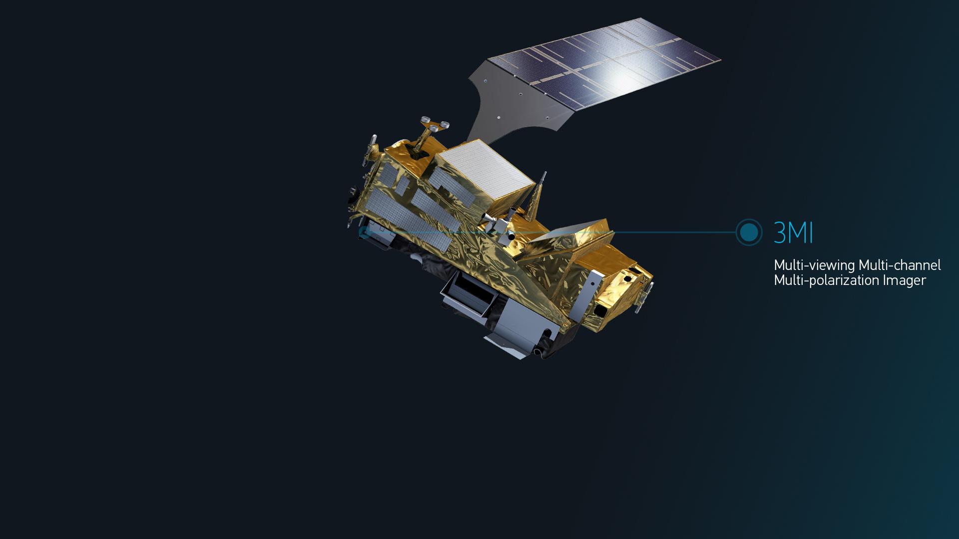
Illustration of METOP-SG A satellite
© EUMETSAT

The OGC software


The 3MI instrument is under the responsibility of Leonardo, based in Florence (Italy), which is in charge of the design and implementation of the H/W and SW instruments. CSL is the Leonardo subcontractor for the calibration of the 3MI instrument. It will be launched on the A-satellite platform of the global METOP-SG programme, which will be operated by EUMETSAT.

Magellium’s Earth Observation unit is CSL’s subcontractor. It is in charge of the implementation of the 3MI On Ground Calibration (OGC) software and the generation and maintenance of the 3MI ATBD (instrument data processing algorithms).


The 3MI OGC software consists of 3 main components:

 IMOD/CMOD implements the Instrument Model and the Inverted Calibration Model:

IMOD simulates the behaviour of the instrument taking into account Spatial and Spectral filtering, and the different radiometric artefacts such as Dark Current, Non-Linearity, Flat-Field, Straylight, etc…IMOD covers the same functional scope as the L0 processing in IDS

CMOD implements the necessary corrections to compensate for instrument artefacts. CMOD covers the same functional scope as L1B1 processing and RIM processing within GPP.

ICCDB, implemented in NetCDF format, and containing all Key Data Parameters (KDP) used by both 3MI IDS&GPP and 3MI OGC SW.
Linked to ICCDB, the dedicated software allows to simulate a synthetic version of ICCDB for testing purposes.

KDPM implements the calculation of all KDPs from the measurements acquired during the calibration campaigns. It also includes dedicated software to allow the simulation of measurements.

observation terre magellium

3MI IDS and GPP L1B1 project

The context

Magellium’s Earth Observation unit is the subcontractor to Leonardo for 3MI IDS (instrument data simulation) & GPP SW (prototype processing chain to generate products up to L1B1 level).

The 3MI IDS is to be used to replace the current 3MI instrument flight models until its delivery and integration. In the meantime, this should allow the validation of the L1B1 GPP with simulated data.

The 3MI GPP L1B1 is intended to provide a prototype L1B1 processing chain. This processing chain should then be used by EUMETSAT as a reference chain for the operational production chain (PDAP) within the METOP-SG ground segment.

Finally, the 3MI IDS & GPP L1B1 project is currently in its final phase (SRR delivery in 2016, PDR, TRR and V1 in 2017, V2 delivery in 2018, intermediate versions in 2019/2020/2021), taking into account the results of the EM calibration campaign.

The mission

The 3MI GPP L1B1 software consists of three main components:

IDS, the 3MI instrument simulator, generating :

L0 data (Image, Ancillary, NAVATT) in NetCDF4 format and CCSDS format for GPP purposes, simulating future EGSE outputs (3MI and satellite level),

intermediate data L0 and simulated luminance for validation purposes taken into account by the PAT (Performance Analysis Tool),

GPP, the 3MI L1B1 correction processing, taking as input :

CCSDS stream file from IDS or EGSE,

Product L0 (CCSDS packets encapsulated in NetCDF4 format) from IOV, and generating:

Product L0,

→ L1B1 product (to be provided as the main input to the 3MI GPP L1B1/L1B),

→ L1B1 ground radiation and intermediate data for validation purposes taken into account by PAT,

PAT, used to jointly validate IDS and GPP outputs.

GPP 3MI L1B1/L1B processing

Magellium’s Earth Observation unit is a subcontractor of CNES for the prototyping of the processing chain from level L1b1 to level L1B.

3mi magellium gpp metop

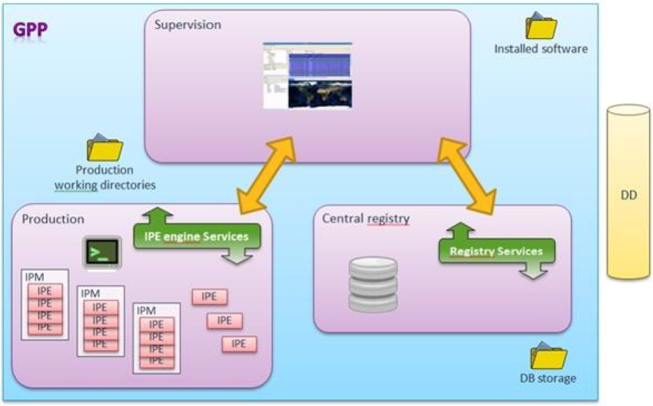
The L1b1/L1b processing calculates the Stokes vectors from L1b1 products in the acquisition sensor reference frame. In a first step, the 3 acquisitions, corresponding to the 3 polarisations under which the same spectral band and the same scene were acquired, are co-registered. Then, in a second step, their radiometric model is inverted in order to calculate the Stokes vector. For unpolarised bands, the processing is based on the Stokes parameters of the neighbouring polarised spectral bands.

nous contacter observation terre magellium

Consortium

EUMETSAT, ESA, Leonardo, CSL, CNES

Key words

observation, satellite, earth, ground segment, 3MI, Metop, EUMETSAT, calibration, c++, prototype, L1B1 processing, ground segment

observation de la terre

SCIENCE FOR EARTH CARE

The Earth Observation Unit of Magellium  is an expert in optical space missions and geophysical and biophysical applications. The EO unit provides high level of expertise and full capacity on the whole processing chain, enabling it to respond to all projects from the greatest space orders such as ESA and CNES.

Contact

eo@magellium.fr

+33 5 62 24 70 00

1, rue Ariane
31520 Ramonville Saint-Agne FRANCE

More info

www.magellium.com

Follow us

3MI

3MI (Multi-acquisition Multi-bandes spectrales et Multi-polarisation) est un instrument imageur de Metop-SG A

nous contacter observation terre magellium

Mission

On Ground Calibration (OGC), définition des algorithmes de traitements des données instrument 3MI (ATBD),

Conception et développement de l’IDS (Instrument Data Simulator) permettant la production des données simulées de niveau 0,

Conception et développement des prototypes GPPs  de traitements des données 3MI permettant la génération des produits de niveau 1 et intermédiaire,

Conception et développement du PAT (Performance Assessment Tool).

Satellites / Instruments

Satellite Metop-SG A embarquant 6 instruments dont 3MI

U

Compétences

Prototypage, simulation, langage C++, traitements L0/L1B1/L1B, étalonnage, calibration

Date

De 2016 à aujourd’hui

Les satellites Metop-SG A et Metop-SG B

Le programme EPS-SG (EUMETSAT Polar System – Second Generation) est composé de deux satellites : Metop-SG A et Metop-SG B. Ce programme a pour objectif de fournir une continuité des observations satellitaires en orbite basse pour la météorologie opérationnelle, l’océanographie, la chimie de l’atmosphère et le suivi du climat. Ainsi, il répondra aux besoin des utilisateurs durant la période allant de 2020 à 2040.

Metop-SG A et Metop-SG B évoluent sur la même orbite et ont des configurations différentes. Les bénéfices ou applications de cette mission  sont centrés sur les prévisions météorologiques, le changement climatique, la qualité de l’air (composition atmosphérique), l’hydrologie, l’océanographie, etc…

Retrouvez plus d’informations générales sur la mission 3MI sur le site de l’EUMETSAT.

segment sol observation terre 3MI magellium

Illustration du satellite METOP-SG A
© EUMETSAT

Le logiciel OGC

L’instrument 3MI est sous la responsabilité de la société Leonardo basée à Florence (Italie) en charge de la conception et de la mise en œuvre H/W et SW de l’instrument. CSL est le sous-traitant Leonardo pour l’étalonnage de l’instrument 3MI. Il sera lancé sur la plate-forme du satellite A du programme mondial METOP-SG qui sera opéré par EUMETSAT.

L’unité Observation de la Terre de Magellium est le sous-traitant de CSL. Elle est en charge de la mise en œuvre du logiciel 3MI On Ground Calibration (OGC) ainsi que de la génération et de la maintenance de l’ATBD 3MI (algorithmes des traitements des données instrument).


Le logiciel 3MI OGC est constitué par 3 principaux composants :

• IMOD/CMOD implémente le MODèle d’Instrument et le MODèle inversé de Calibration :

⇒ IMOD simule le comportement de l’instrument en prenant en compte le filtrage Spatial et Spectral, et les différents artefacts radiométriques tels que Dark Current, Non-Linearity, Flat-Field, Straylight, etc…IMOD couvre le même périmètre fonctionnel que le traitement L0 dans IDS

⇒ CMOD implémente les corrections nécessaires pour compenser les artefacts de l’instrument. CMOD couvre le même périmètre fonctionnel que le traitement L1B1 et le traitement RIM au sein de GPP.

• ICCDB, implémenté au format NetCDF, et contenant tous les Key Data Parameters (KDP) utilisés à la fois par 3MI IDS&GPP et 3MI OGC SW.
Lié à l’ICCDB, le logiciel dédié permet de simuler une version synthétique de l’ICCDB à des fins de test.

• KDPM met en œuvre le calcul de tous les KDP à partir des mesures acquises lors des campagnes d’étalonnage. Il comprend également un logiciel dédié pour permettre la simulation de mesures.

Le projet 3MI IDS et GPP L1B1

Le contexte

L’unité Observation de la Terre de Magellium est le sous-traitant de Leonardo pour 3MI IDS (simulation des données instrument) & GPP SW (prototype de la chaine traitements permettant la génération des produits jusqu’au niveau L1B1).

Le 3MI IDS doit être utilisé pour remplacer les modèles de vol aux instruments 3MI actuels jusqu’à sa livraison et son intégration. Cela doit permettre entre-temps la validation du GPP L1B1 avec des données simulées.

Le 3MI GPP L1B1 a pour objectif de fournir un prototype de chaîne de traitement L1B1. Cette chaîne de traitement doit pouvoir ensuite être utilisée par EUMETSAT comme chaîne de référence pour la chaîne de production opérationnelle (PDAP) au sein du segment sol METOP-SG.

Enfin, le projet 3MI IDS & GPP L1B1 est actuellement en phase finale (livraison SRR en 2016, PDR, TRR et V1 en 2017, livraison V2 en 2018, versions intermédiaires en 2019/2020/2021), prenant en compte les résultats de la campagne de calibration EM.

La mission

Le logiciel 3MI GPP L1B1 comprend trois composants principaux :

• IDS, le simulateur d’instruments 3MI, générant :

⇒ des données L0 (Image, Ancillary, NAVATT) au format NetCDF4 et au format CCSDS à des fins GPP, simulant les futures sorties EGSE (niveau 3MI et satellite),

⇒ des données intermédiaires L0 et luminance simulée à des fins de validation prise en compte par le PAT (Performance Analysis Tool),

• GPP, le traitement de correction 3MI L1B1, prenant en entrée :

⇒ Fichier de flux CCSDS provenant d’IDS ou d’EGSE,

⇒ Produit L0 (paquets CCSDS encapsulés au format NetCDF4) d’IOV, et générant :

Produit L0,

Produit L1B1 (à fournir comme entrée principale du 3MI GPP L1B1/L1B),

Radiance au sol et données intermédiaires L1B1 à des fins de validation prises en compte par PAT,

•  PAT, utilisé pour valider conjointement les sorties IDS et GPP.

Le traitement GPP 3MI L1B1/L1B

L’unité Observation de la Terre de Magellium est sous-traitant du CNES dans le cadre du prototypage de la chaîne de traitement du niveau L1b1 vers le niveau L1B.

3mi magellium gpp metop

Le traitement L1b1/L1b calcule les vecteurs de Stokes à partir de produits L1b1 dans le référentiel capteur d’acquisition. Dans un premier temps, les 3 acquisitions, correspondant aux 3 polarisations sous lesquelles ont été acquises une même bande spectrale et une même scène, sont co-registrées. Puis, dans un second temps, leur modèle radiométrique est inversé afin de calculer le vecteur de Stokes. Pour les bandes non-polarisées, le traitement s’appuie sur les paramètres de Stokes des bandes spectrales polarisées voisines.

nous contacter observation terre magellium

Consortium

EUMETSAT, ESA, Leonardo, CSL, CNES

Mots-clés

observation, satellite, terre, segment sol, 3MI, Metop, EUMETSAT, étalonnage, c++, prototype, traitement L1B1, segment sol

observation de la terre

SCIENCE FOR EARTH CARE

L'unité Observation de la Terre de Magellium est experte en missions spatiales optiques et en applications géophysiques et biophysiques. L'unité offre un haut niveau d'expertise et une complète maîtrise sur l'ensemble de la chaîne de traitement, lui permettant de répondre à tous les projets des plus grandes commandes spatiales telles que l'ESA et le CNES.

Contact

eo@magellium.fr

+33 5 62 24 70 00

1, rue Ariane
31520 Ramonville Saint-Agne FRANCE

Plus d'infos

www.magellium.com

Suivez-nous