OBS2CO
OBS2CO
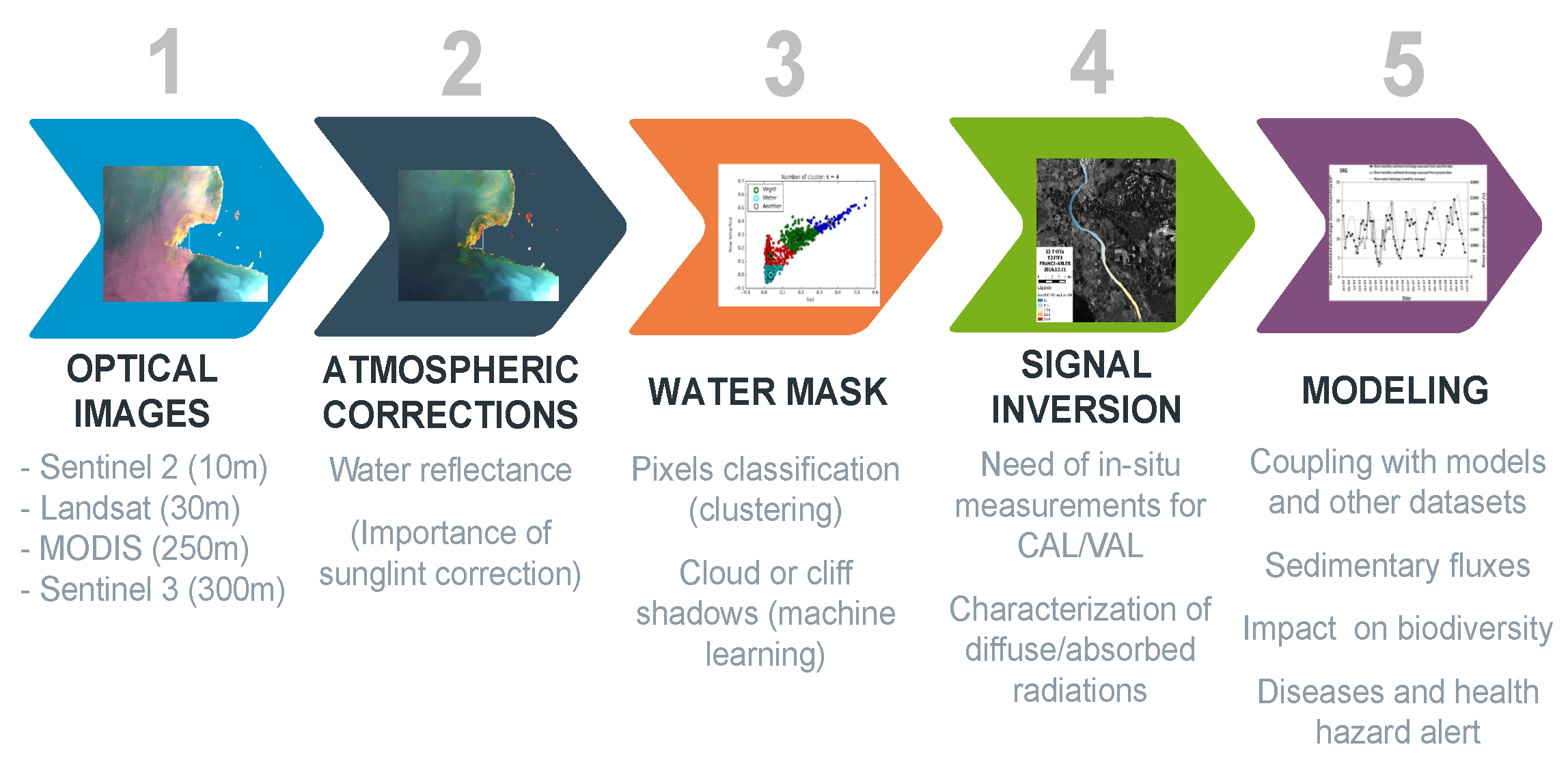
CNES-Hysope-2 treatment line for colour and water quality analysis

Mission
Monitoring water quality in lakes and rivers
Instruments
Sentinel-2, Landsat, MODIS, Sentinel-3
Skills
Combining satellite data, earth observation and in-situ measurements
Date
From 2019 to today
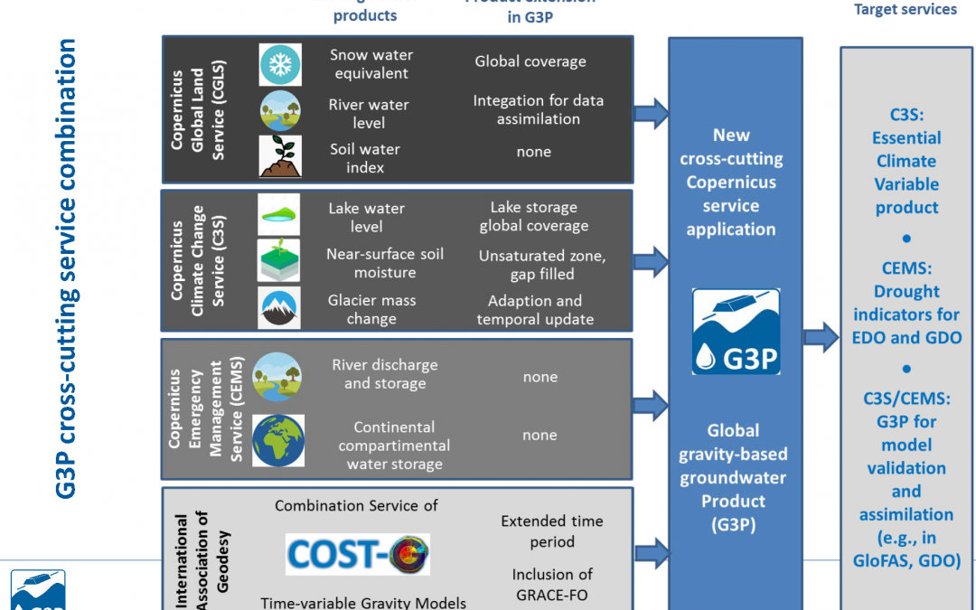
The OBS2CO project
The OBS2CO (OBServation of COntinental water COlour) project enables multi-satellite observation of continental water. The project relies on Earth observation-based water quality monitoring tools and other innovative tools.
In-situ data are essential to calibrate and validate the models. However, satellite data is still essential as it complements the in-situ data.
![]()
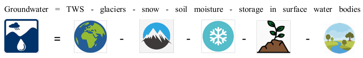
Ocean heat content
The Earth Observation unit is in charge of the OBS2CO treatment chain. There is a collaboration between the research teams and the water agencies in order to design a water quality product that complies with the users.
More details can be found in the OBS2CO brochure.
The objectives of OBS2CO
-
-
Development of an automated processing chain for satellite water quality with atmospheric corrections dedicated to surface waters
-
-
-
Large in-island data set for calibration and validation over the full turbidity range (from oligotrophic and transparent to extremely turbid waters)
-
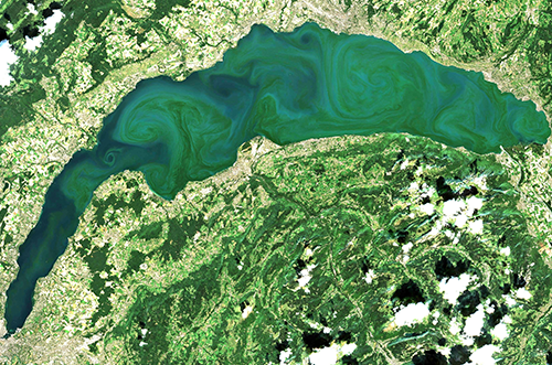
Large phytoplankton bloom on Lake Geneva, Switzerland
Key partners
CNES, GéoscienceSs Environnement Toulouse (GET)
Key words
observation, satellite, earth, studies, quality, water, hydrology, processing chain, in-situ data, atmospheric corrections
SCIENCE FOR EARTH CARE
The Earth Observation Unit of Magellium is an expert in optical space missions and geophysical and biophysical applications. The EO unit provides high level of expertise and full capacity on the whole processing chain, enabling it to respond to all projects from the greatest space orders such as ESA and CNES.