Trishna

Trishna

Trishna

Thermal infraRed Imaging Satellite for High-resolution Natural resource Assessment
Technical support for CNES

cnes centre national etudes spatiales observation terre

Mission

Measure surface temperatures all over the globe

Satellite / Instruments

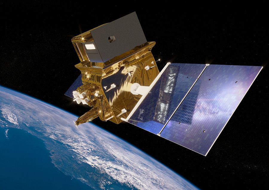
Trishna satellite

TIR (Thermal InfraRed)
VNIR/SWIR (Visible and Near InfraRed/Short Wave InfraRed)

U

Skills

Geometric modelling

Date

Expected launch : 2025

The Trishna project


Vegetation plays an important role in the functioning of the Earth’s surface as it regulates the exchange of energy and substances (CO2, H2O, etc.). Visible sensors have made it possible to monitor the evolution (growth, maturity, ageing) of vegetation from space. However, plants can suffer from water stress, which raises the temperature of the plants. This stress can be observed in the infrared thermal range.

Currently, such space-based thermal measurements only exist at a resolution of about 100 metres at a monthly frequency, while at the global daily scale they are only available at kilometre resolution.

The Trishna mission, a collaboration between CNES (France) and ISRO (India), will collect thermal infrared images of the Earth’s surface with a resolution of 57 metres and a revisit every three days.

observation terre magellium

trishna cnes magellium vegetation

Illustration of Trishna satellite
© CNES/ill./REGY Michel, 2021

The Trishna satellite is therefore a specialised infrared and earth observation satellite. It observes vegetation zones and monitors soil temperatures. In this way, it can monitor the evolution of crops and vegetation around the world.

The unit is involved in the geometric modelling of the acquisitions sent by the satellite.

To find out more about the Trishna mission, visit the CNES website for Trishna.

nous contacter observation terre magellium

The objectives of Trishna


    Part of the unit is based in the CNES offices in order to best meet the needs of the project.

    The objective of the Trishna project is to understand the local evolution of biological (water stress, transpiration), physical (evaporation, sublimation, plume zones) and climatic (global observation over time) phenomena related to the water cycle.

    Key words

    observation, satellite, earth, studies, geometric modelling, Trishna, CNES, France, ISRO, India, thermal sensor

    observation de la terre

    SCIENCE FOR EARTH CARE

    The Earth Observation Unit of Magellium  is an expert in optical space missions and geophysical and biophysical applications. The EO unit provides high level of expertise and full capacity on the whole processing chain, enabling it to respond to all projects from the greatest space orders such as ESA and CNES.
    Contact

    eo@magellium.fr

    +33 5 62 24 70 00

    1, rue Ariane
    31520 Ramonville Saint-Agne FRANCE

    More info

    www.magellium.com

    Follow us

    Trishna

    Trishna

    Trishna

    Thermal infraRed Imaging Satellite for High-resolution Natural resource Assessment
    Soutien technique pour le CNES

    cnes centre national etudes spatiales observation terre

    Mission

    Mesurer la température de surface de l’ensemble du globe terrestre

    Satellite / Instruments

    Satellite Trishna

    TIR (Thermal InfraRed)
    VNIR/SWIR (Visible and Near InfraRed/Short Wave InfraRed)

    U

    Compétences

    Modélisation géométrique

    Date

    Date de lancement prévue en 2025

    Le projet Trishna


    La végétation joue un rôle important dans le fonctionnement de la surface terrestre car elle régule les échanges d’énergie et de substances (CO2, H2O, etc.). Des capteurs visibles ont permis de suivre l’évolution (croissance, maturité, vieillissement) de la végétation depuis l’espace. Cependant, les plantes peuvent souffrir de stress hydrique, ce qui élève la température des plantes. Cette tension peut être observée dans le domaine thermique infrarouge.

    Actuellement, ces mesures thermiques spatiales n’existent qu’à une résolution d’environ 100 mètres à une fréquence mensuelle, tandis qu’à l’échelle globale journalière n’est disponible qu’à la résolution kilométrique.

    Née d’une collaboration entre le CNES (France) et l’ISRO (Inde), la mission Trishna recueillera des images de la surface terrestre dans l’infrarouge thermique avec une résolution de 57 mètres et une revisite tous les trois jours.

    trishna cnes magellium vegetation

    Illustration du satellite Trishna
    © CNES/ill./REGY Michel, 2021

    Dès lors, le satellite Trishna est un satellite spécialisé dans le domaine de l’infrarouge et de l’observation de la Terre. Il observe les zones végétales et suit les températures des sols. Ainsi, il permet de suivre l’évolution des cultures et de la végétation dans le monde.

    L’unité intervient dans la modélisation géométrique des acquisitions envoyées par le satellite.

    Pour en savoir plus sur la mission Trishna, visitez le site du CNES dédié à la mission Trishna.

    nous contacter observation terre magellium

    Les objectifs de Trishna


      Une partie de l’unité est basée dans les locaux du CNES afin de mieux répondre au projet.

      L’objectif du projet Trishna est de comprendre l’évolution locale des phénomènes biologiques (stress hydrique, transpiration), physiques (évaporation, sublimation, zones de panache), climatiques (observation globale sur la durée) en lien avec le cycle de l’eau.

      Mots-clés

      observation, satellite, terre, études, modélisation géométrique, Trishna, CNES, France, ISRO, Inde, capteur thermique

      observation de la terre

      SCIENCE FOR EARTH CARE

      L'unité Observation de la Terre de Magellium est experte en missions spatiales optiques et en applications géophysiques et biophysiques. L'unité offre un haut niveau d'expertise et une complète maîtrise sur l'ensemble de la chaîne de traitement, lui permettant de répondre à tous les projets des plus grandes commandes spatiales telles que l'ESA et le CNES.

      Contact

      eo@magellium.fr

      +33 5 62 24 70 00

      1, rue Ariane
      31520 Ramonville Saint-Agne FRANCE

      Plus d'infos

      www.magellium.com

      Suivez-nous

      Lunar DEM

      Lunar DEM

      Lunar DEM

      3D reconstruction of the lunar surface by stereo-restitution

      Mission

      Reconstruction 3D de la surface lunaire

      Instruments

      Sonde Lunar Reconnaissance Orbiter (LRO)

      U

      Compétences

      Reconstruction 3D, géométrie, modélisation numérique de surface

      Date

      De 2020 à aujourd’hui

      The Lunar DEM project


      This project is part of a study for Airbus Defense & Space.

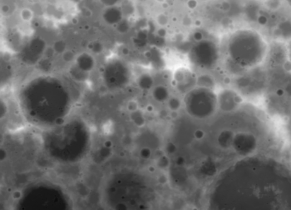
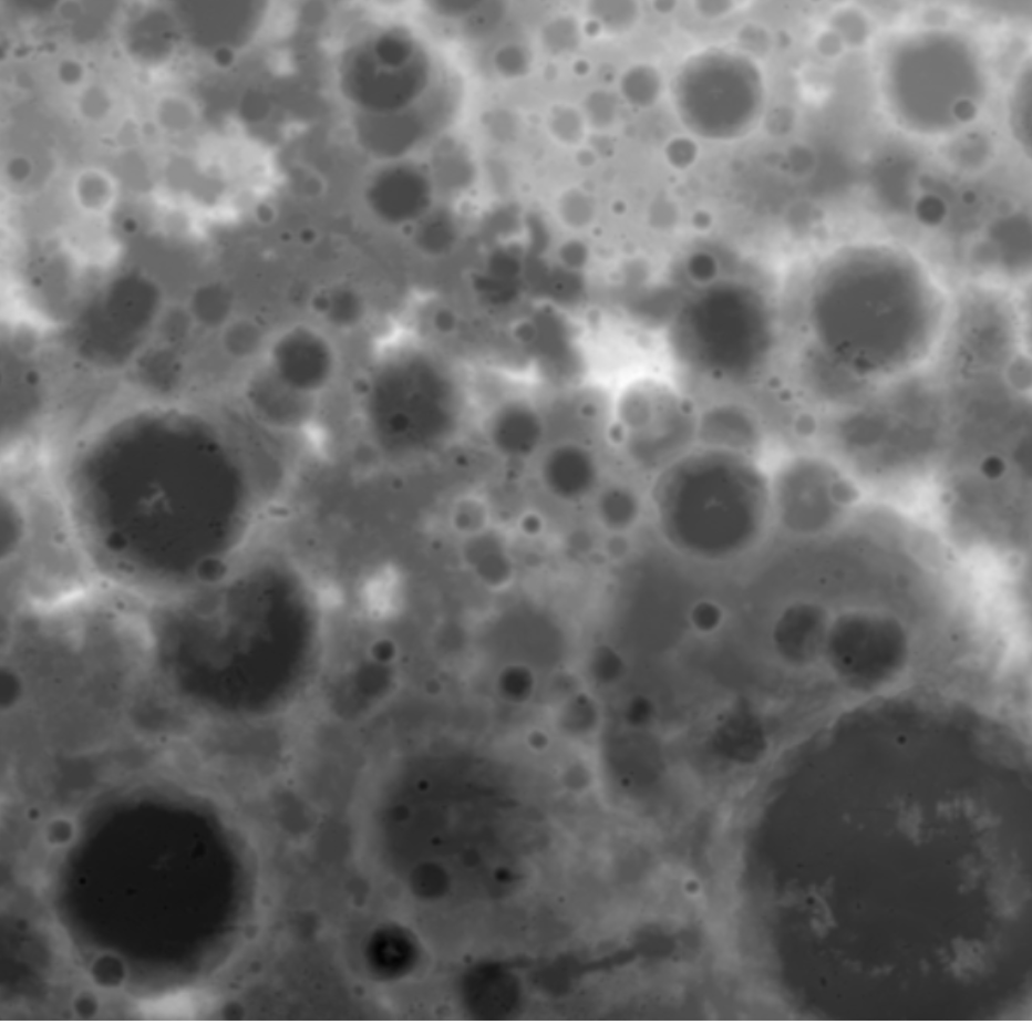
      The objective of this project is to calculate the most detailed Digital Surface Model (DSM) possible. This DSM is calculated from the images of the Narrow Angle Scanning (NAC) cameras of the Lunar Reconnaissance Orbiter (LRO).

      LRO is a NASA robotic spacecraft. Launched in 2009, it is part of the US Vision for Space Exploration programme. The data received by this spacecraft is characterised as being essential for “planning NASA’s future human and robotic missions to the Moon”.

      More about LRO here.

      nous contacter observation terre magellium

      The LUNAR DEM objectives


          • Prototyping of a processing chain performing the optimisation of the geometric model of the cameras

          • Stereo-restitution of the lunar surface and optimisation by the shape-from-shading algorithm
      lunar dem lune magellium airbus

      Key partner

      CNES

      Key words

      observation, satellite, Moon, studies, DSM, MNS, geometry, sensor, reconstruction, 3D, NASA

      observation de la terre

      SCIENCE FOR EARTH CARE

      The Earth Observation Unit of Magellium  is an expert in optical space missions and geophysical and biophysical applications. The EO unit provides high level of expertise and full capacity on the whole processing chain, enabling it to respond to all projects from the greatest space orders such as ESA and CNES.
      Contact

      eo@magellium.fr

      +33 5 62 24 70 00

      1, rue Ariane
      31520 Ramonville Saint-Agne FRANCE

      More info

      www.magellium.com

      Follow us

      Merlin

      Merlin

      Merlin

      Methane Remote Sensing Lidar Mission
      Soutien technique pour le CNES

      cnes centre national etudes spatiales observation terre

      Mission

      Measure the concentration of methane in the atmosphere and identify the sources of this greenhouse gas

      Instrument

      LIDAR IPDA

      U

      Skills

      Radiometry, signal processing, radiative transfer

      Date

      From 2003 to today
      Expected launch date 2027

      The MERLIN project


      Methane is a major contributor to climate change. Indeed, one tonne of methane contributes 25 times more to climate change than one tonne of CO2 on a time scale of 100 years. It is produced both by natural and human actions. However, its production remains largely linked to human activities. Indeed, its quantity has doubled since the beginning of the industrial era.
      This is why it is essential to accurately measure the amount of atmospheric methane in order to understand the workings of our climate.

      projet merlin cnes magellium changement climat

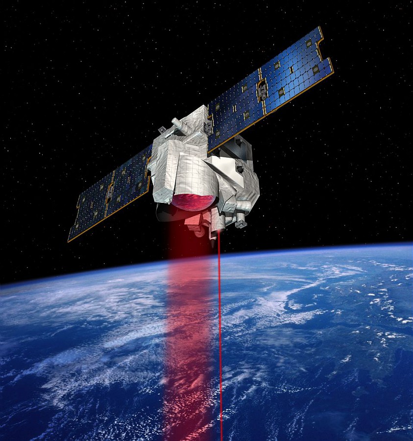
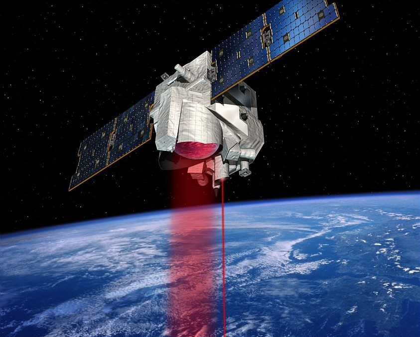
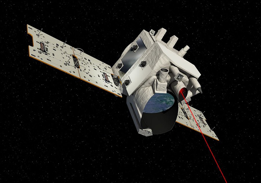
      Illustration of the MERLIN satellite
      © CNES/ill./DUCROS David, 2016

      To carry out these measurements, the Merlin satellite uses a method that allows for unequalled precision. It will be equipped with the LIDAR IPDA for Integrated Path Differential Absorption. Its launch is scheduled for 2024. This mission is being developed jointly by the French CNES and German DLR space agencies.

      The unit contributes to the definition of the algorithm of the processing chain, tests and validates the performance assumptions. It also carries out scientific studies on the geophysics of the measurement, and participates in the creation of an orbital simulator for any LIDAR IPDA satellite.

      Learn more about the MERLIN mission on the CNES website.

      nous contacter observation terre magellium

      The objectives


        Part of the unit is based at the CNES premises in order to better respond to the project.

        The objective of the MERLIN project is to accurately measure the amount of methane in the atmosphere and to know its sources. To achieve this, our activity is based on these essential points:


        geometric model: L1 first geolocation

        preparation for validation

        modelling the spatio-temporal variability of methane

        comparison of weighting functions with TCCON

        estimation of the SNR in flight

        projet merlin cnes magellium changement climat

        Illustration of Merlin satellite
        © CNES/DUCROS David, 2016

        Key words

        observation, satellite, earth, studies, climate change, methane, greenhouse gases, ground segment, LIDAR, geometric modeling

        observation de la terre

        SCIENCE FOR EARTH CARE

        The Earth Observation Unit of Magellium  is an expert in optical space missions and geophysical and biophysical applications. The EO unit provides high level of expertise and full capacity on the whole processing chain, enabling it to respond to all projects from the greatest space orders such as ESA and CNES.
        Contact

        eo@magellium.fr

        +33 5 62 24 70 00

        1, rue Ariane
        31520 Ramonville Saint-Agne FRANCE

        More info

        www.magellium.com

        Follow us

        Merlin

        Merlin

        Merlin

        Methane Remote Sensing Lidar Mission
        Soutien technique pour le CNES

        cnes centre national etudes spatiales observation terre

        Mission

        Mesurer la concentration de méthane dans l’atmosphère et identifier les sources de ce gaz à effet de serre

        Instrument

        LIDAR IPDA

        U

        Compétences

        Radiométrie, traitement du signal, transfert radiatif

        Date

        De 2003 à aujourd’hui
        Date de lancement prévue en 2027

        Le projet MERLIN


        Le méthane est un gaz contribuant grandement au changement climatique. En effet, une tonne de méthane contribue 25 fois plus au changement climatique qu’une tonne de CO2 sur une échelle de temps de 100 ans. Il est à la fois produit par actions naturelles mais aussi par actions humaines. Or, sa production reste largement lié aux activités humaines. En effet, sa quantité a doublé depuis le début de l’ère industrielle.
        C’est pourquoi il est essentiel de mesurer avec précision la quantité de méthane atmosphérique dans le but de comprendre les rouages de notre climat.

        projet merlin cnes magellium changement climat

        Illustration du satellite MERLIN
        © CNES/ill./DUCROS David, 2016

        Pour réaliser ces mesures, le satellite Merlin utilise une méthode qui permet une précision inégalée. Il disposera du LIDAR IPDA pour Integrated Path Differentiel Absorption. Son lancement est prévu pour 2024. Cette mission est développée conjointement entre les agences spatiales CNES (française) et DLR (allemande).

        L’unité contribue à la définition de l’algorithmie de la chaine de traitement, teste et valide les hypothèses de performance. Aussi, elle réalise des études scientifique sur la géophysique de la mesure, et participe à la création d’un simulateur orbital pour tout satellite LIDAR IPDA.

        En savoir plus sur la mission MERLIN sur le site du CNES.

        nous contacter observation terre magellium

        Les objectifs


          Une partie de l’unité est basée dans les locaux du CNES afin de mieux répondre au projet.

          L’objectif du projet MERLIN est de mesurer avec précision la quantité de méthane dans l’atmosphère et en connaître les sources. Pour cela, notre activité réside autour de ces points essentiels :


          modèle géométrique : L1 première géolocalisation

          préparation à la validation

          modélisation de la variabilité spatio-temporelle du méthane

          comparaison des fonctions de pondération avec TCCON

          estimation du SNR en vol

          projet merlin cnes magellium changement climat

          Illustration du satellite Merlin
          © CNES/DUCROS David, 2016

          Mots-clés

          observation, satellite, terre, études, changement climatique, méthane, gaz à effet de serre, segment sol, LIDAR, modélisation géométrique

          observation de la terre

          SCIENCE FOR EARTH CARE

          L'unité Observation de la Terre de Magellium est experte en missions spatiales optiques et en applications géophysiques et biophysiques. L'unité offre un haut niveau d'expertise et une complète maîtrise sur l'ensemble de la chaîne de traitement, lui permettant de répondre à tous les projets des plus grandes commandes spatiales telles que l'ESA et le CNES.

          Contact

          eo@magellium.fr

          +33 5 62 24 70 00

          1, rue Ariane
          31520 Ramonville Saint-Agne FRANCE

          Plus d'infos

          www.magellium.com

          Suivez-nous