Copernicus HR-S&I

Copernicus HR-S&I

Copernicus HR-S&I

Copernicus High Resolution Snow & Ice

copernicus magellium
eea agence europeenne environnement magellium copernicus

Mission

Implementation and operation of a near real-time processing chain for snow and ice monitoring over Europe

Satellites

High resolution Sentinel-1 and Sentinel-2 data

U

Skills

Cloud computing, operations, automation, algorithms, project management

Date

From 2019 to today

Copernicus HR-S&I, the product


Copernicus is a European programme aimed to collect, process and update data on the condition of the Earth. The data collected concerns the environment, security, the maritime domain, disaster monitoring, agriculture, etc. These data are made available for autonomous European monitoring at different scales (local, regional, global). These data also contribute to monitoring and dealing with the effects of climate change.

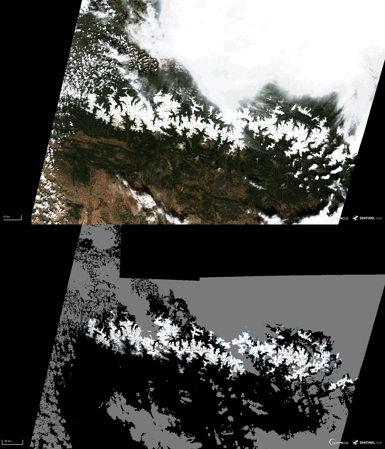
Since 2020, the Copernicus Land Monitoring Service (CLMS) has been publishing its high-resolution snow and ice monitoring products (HR-S&I) in near-real time. Indeed, the presence of snow and ice on lakes and rivers is a relevant element to monitor because of their strong influence on the water cycle and surface energy fluxes. Rapid declines in the extent and duration of snow cover and increases in the number of extreme events are distinct indicators of global climate change. Therefore, the study of these parameters is crucial for a wide range of applications, both for the private sector, local authorities and scientific institutions.
snow and ice pyrenees copernicus climat environnement magellium

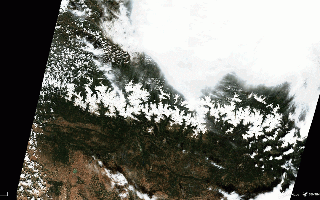
Snow cover in the Pyrenees on 27/09/2020 – fractional snow product (FSC) generated by the Earth Observation Unit in Magellium
© European Union, Copernicus Land Monitoring Service 2021, European Environment Agency (EEA)

In 2019, Magellium was awarded a contract by the European Environment Agency (EEA) to develop, operate and promote a new Copernicus Core Service. This service provides high-resolution monitoring of snow and ice in Europe and Turkey. From then on, the EO unit is in charge of the implementation of sustainable and operational snow and ice monitoring products.

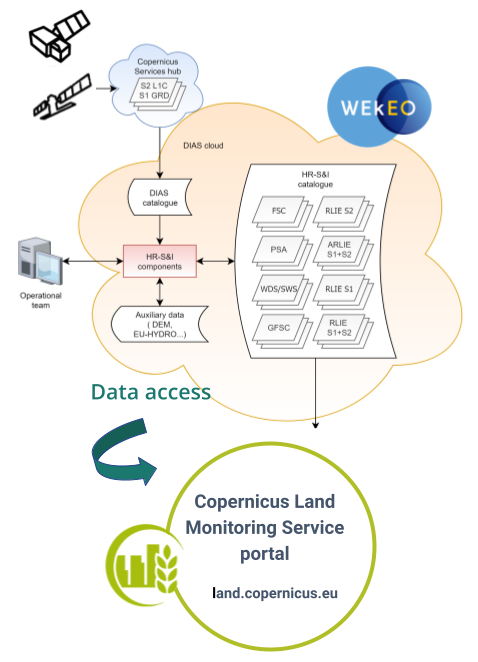
Operations started in July 2020 on a 24-hour basis. A state-of-the-art automatic processing solution has been deployed on a European cloud (DIAS). This provides scalability capabilities. Production is triggered whenever Sentinel-1 and Sentinel-2 acquisitions are available and the resulting products are made available to users on average within 6 hours after the measurement. Campaigns to process the huge amount of data already acquired by the constellations have been carried out. More than one million products have been generated and are currently hosted on DIAS.

HR-S&I products in a few words :

      • 550 Sentinel-2 products and 230 Sentinel-1 products
      • 2700 HR-S&I products processed each day
      • 5 snow products, 4 ice products
      • Sentinel-2 and Sentinel-1 archives already processed (since September 2016)
      • Various applications: hydrology, hydroelectricity, meteorology, security, research and development, etc.

The HR-S&I products can be viewed and downloaded free of charge on the DIAS WEkEO portal: https://www.wekeo.eu/.

Find more information on the Copernicus website.
Find more details on HR-S&I products on the specific Copernicus website.

nous contacter observation terre magellium

The objectives


    • Set up and maintain an operational system on a European cloud
    • Optimise the processing of hundreds of satellite data items each day to deliver snow and ice products to users as quickly as possible
    • Support the European Environment Agency in sustainability and product promotion
    copernicus land snow ice magellium

    Key partners

    Astri Polska, CESBIO, Finnish Meteorological Institute (FMI), ENVEO

    Key words

    observation, satellite, Earth, climate change, Copernicus services, snow, ice, lakes and rivers, Europe, Sentinel

    observation de la terre

    SCIENCE FOR EARTH CARE

    The Earth Observation Unit of Magellium  is an expert in optical space missions and geophysical and biophysical applications. The EO unit provides high level of expertise and full capacity on the whole processing chain, enabling it to respond to all projects from the greatest space orders such as ESA and CNES.

    Contact

    eo@magellium.fr

    +33 5 62 24 70 00

    1, rue Ariane
    31520 Ramonville Saint-Agne FRANCE

    More info

    www.magellium.com

    Follow us

    Jilin-1 SP

    Jilin-1 SP

    Jilin-1 SP

    Mission

    Provide high resolution satellite imagery for mapping

    Satellites

    Jilin-1, remote sensing satellite

    U

    Skills

    Geometric and radiometric calibration, image quality, remote sensing, monitoring evaluation

    Date

    2021

    Jilin-1 SP project


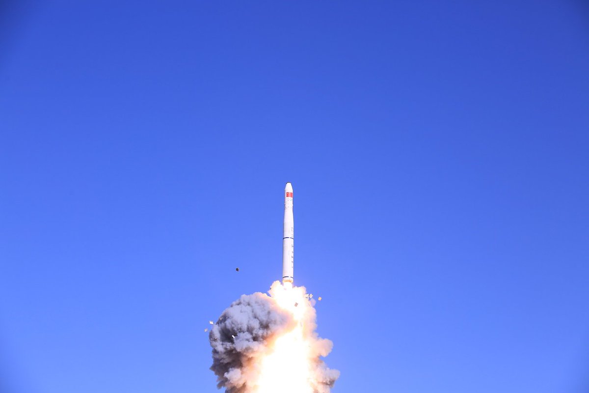
    Jilin is a constellation of Earth observation satellites developed by the Chinese company Chang Guang Satellite Technology. The two sensors of Jilin-1 Hyperspectral Satellite were successfully launched in January 2019.

    The Jilin satellites aim to commercialise satellite space imagery. Therefore, they provide high resolution satellite imagery of 5 meters with 27 hyperspectral bands. Jilin-1 is useful for mapping, environmental monitoring, forestry, energy, land use planning and agriculture.

    The unit is involved in this project in several areas. It assesses all key aspects of sensor data quality. These data are then compared with the requirements or specifications of the product sensors. This process uses the sample of sensor products provided.

    nous contacter observation terre magellium

    The objectives for Jilin-1


        • Sensor data quality
          • geometric and radiometric calibration
          • image quality
        • Object detection and tracking
        • Geometry assessment
          • Absolute geolocation accuracy
          • Temporal geolocation accuracy
          • Accuracy of Co-band recording
    jilin satellite observation terre magellium

    Launch of Jilin-1 satellite in 2019

    Key partners

    ESA, EDAP

    Key words

    satellite, China, Jilin, calibration, geometry, radiometry, measurement physics, hyperspectral, remote sensing, image quality

    observation de la terre

    SCIENCE FOR EARTH CARE

    The Earth Observation Unit of Magellium  is an expert in optical space missions and geophysical and biophysical applications. The EO unit provides high level of expertise and full capacity on the whole processing chain, enabling it to respond to all projects from the greatest space orders such as ESA and CNES.
    Contact

    eo@magellium.fr

    +33 5 62 24 70 00

    1, rue Ariane
    31520 Ramonville Saint-Agne FRANCE

    More info

    www.magellium.com

    Follow us

    Spot World Heritage L2

    Spot World Heritage L2

    SPOT World Heritage L2

    Mission

    Tool for connecting high spatial resolution time series to SPOT World Heritage data

    Satellites

    SPOT 1 to SPOT 5 satellites

    U

    Skills

    Radiometry, geometry

    Date

    From 2020 to today

    SPOT World Heritage L2


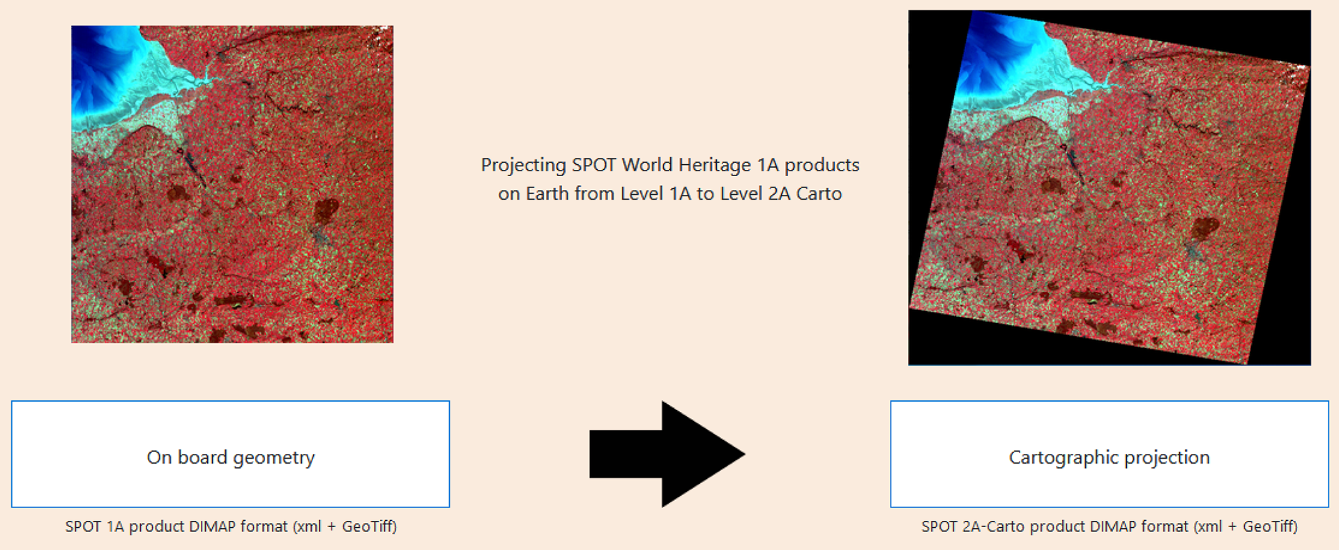
    The SPOT World Heritage (SWH) programme is a CNES (French Centre national d’Etudes Spatiales) initiative to open the SPOT 1-5 archive to users. The archive is unique as it contains nearly 30 million images acquired by this family of satellites. Also, these images have been acquired since 1986.

    The archive is produced by CNES at level 1A and at level 2A by the THEIA centre progressively.

    In short, SWH is a tool for connecting high spatial resolution time series to SPOT World Heritage data.

    nous contacter observation terre magellium

    The objectives for SPOT World Heritage


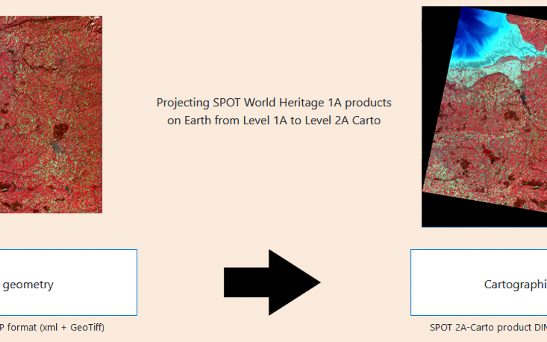
        • While waiting for the complete processing of the archive, a portal has been developed to easily process the raw geometry of the SWH Level 1A products into SWH products in line with the L1C Sentinel 2 products
        • The Carto-2A product is provided in a standard map projection (UTM).
    spot world heritage magellium

    Key partner

    CNES

    Key words

    observation, satellite, earth, studies, image, cartography, SPOT, archive, portal, raw geometry, CNES

    observation de la terre

    SCIENCE FOR EARTH CARE

    The Earth Observation Unit of Magellium  is an expert in optical space missions and geophysical and biophysical applications. The EO unit provides high level of expertise and full capacity on the whole processing chain, enabling it to respond to all projects from the greatest space orders such as ESA and CNES.
    Contact

    eo@magellium.fr

    +33 5 62 24 70 00

    1, rue Ariane
    31520 Ramonville Saint-Agne FRANCE

    More info

    www.magellium.com

    Follow us

    OSMOSE

    OSMOSE

    OSMOSE

    nous contacter observation terre magellium

    Mission

    Study of the opacity of vegetation using passive microwaves

    Instruments

    SMOS, AMSR-E, AMSR-2

    U

    Skills

    Radiometry

    Date

    From 2022 to today

    OSMOSE project


    OSMOSE is an ESA project. It estimates the biomass and opacity of vegetation on the surface of our planet.

    The objectives of OSMOSE


        • Estimate above-ground biomass using passive microwave sensors, such as SMOS, AMSR-E and AMSR-2,
        • Develop harmonised microwave band VOD datasets to assess the evolution of vegetation parameters (e.g. AGB) over the last 20 years from passive microwave sensors,
        • Exploit the optical domain to support the interpretation of vegetation characteristics from passive microwave observations.
    osmose esa vegetation magellium

    The key partners

    ESA, GlobEO, WSL, INRAE, CESBIO, Université Toulouse III Paul Sabatier

    Key words

    observation, study, vegetation, microwave, ESA, radiometry

    observation de la terre

    SCIENCE FOR EARTH CARE

    The Earth Observation Unit of Magellium  is an expert in optical space missions and geophysical and biophysical applications. The EO unit provides high level of expertise and full capacity on the whole processing chain, enabling it to respond to all projects from the greatest space orders such as ESA and CNES.

    Contact

    eo@magellium.fr

    +33 5 62 24 70 00

    1, rue Ariane
    31520 Ramonville Saint-Agne FRANCE

    More info

    www.magellium.com

    Follow us

    ASELSU

    ASELSU

    ASELSU

    Analysis of the uncertainty of the stability of the altimeter measurement of sea level rise (ASELSU)

    agence spatiale europenne esa

    Mission

    Determine whether instrumental improvements are needed for future altimetry missions to meet the new uncertainty requirements for sea level rise stability

    Satellites

    Sentinel-6 Michael Freilich, Sentinel-6 Next generation

    U

    Skills

    Altimetry processing chain, uncertainty propagation, scientific expertise on sea level variation

    Date

    From 2021 to today

    ASELSU project


    ASELSU studies the possibility for the future Sentinel-6 Next Generation altimetry mission to meet the new requirements on sea level rise stability uncertainty. This project, funded by ESA, is led by Magellium with 4 other partners: CLS, LEGOS, NPL and UoR.

    aselsu observation magellium

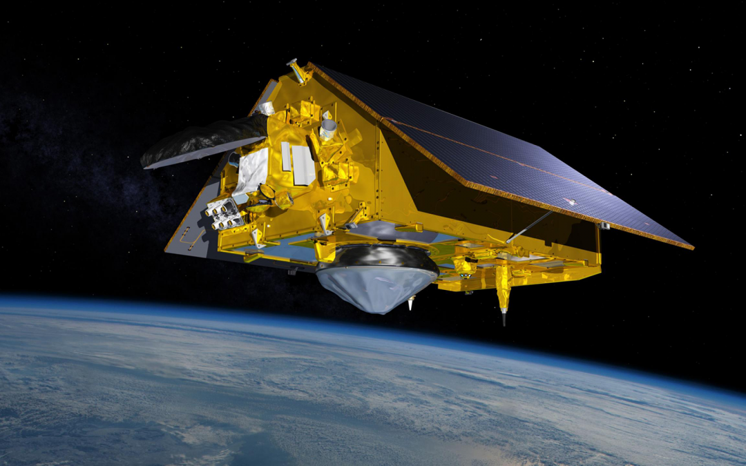
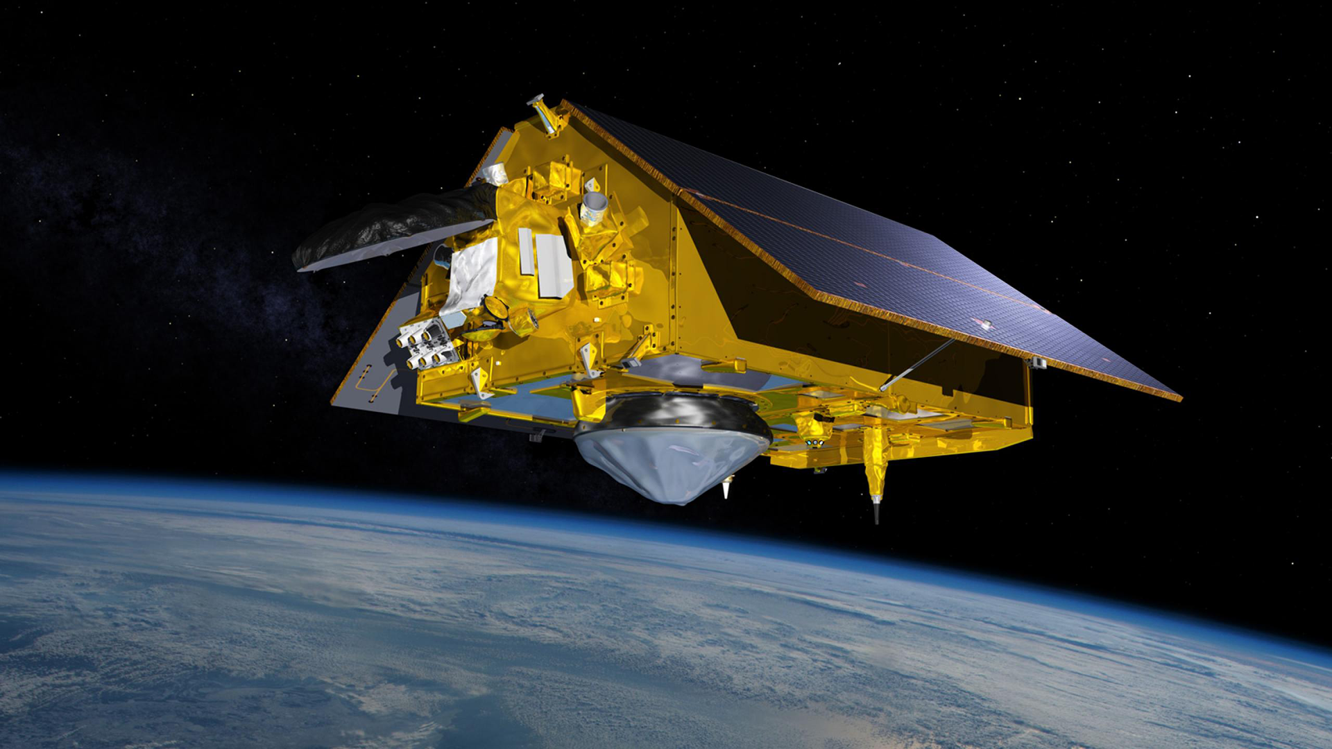
    Illustration of Sentinel-6 Michael Freilich satellite
    © NASA

    The Earth Observation Unit is in charge of the project management. It also provides scientific expertise on sea level and associated uncertainties.

    Find out more about the project on the Black Sea Bluc Company website.nous contacter observation terre magellium

    The objectives of ASELSU


        • Justify the new uncertainty requirements of sea level rise stability for climate change studies
        • Establish the end-to-end uncertainty budget of altimetry measurement at sea level rise following a metrological approach
        • Provide tools to determine whether instrumental improvements to future altimetry missions would be useful and necessary to meet the requirements

        The partners

        Laboratory for Geophysical and Oceanographic Space Studies (LEGOS), Collection Localisation Satellites (CLS), British National Physical Laboratory (NPL), University of Reading (UoR)

        Key words

        observation, satellite, earth, studies, altimetry, uncertainties, metrology, sea level

        observation de la terre

        SCIENCE FOR EARTH CARE

        The Earth Observation Unit of Magellium  is an expert in optical space missions and geophysical and biophysical applications. The EO unit provides high level of expertise and full capacity on the whole processing chain, enabling it to respond to all projects from the greatest space orders such as ESA and CNES.

        Contact

        eo@magellium.fr

        +33 5 62 24 70 00

        1, rue Ariane
        31520 Ramonville Saint-Agne FRANCE

        More info

        www.magellium.com

        Follow us