HYFAA

HYFAA

HYFAA

Hydrological Forecasting system with Altimetry Assimilation

Objective

Developing a hydrological forecasting platform based on the assimilation of altimetric data

Satellites / Instruments

Current and future altimetry missions like Sentinel-3

U

Skills

Altimetry, hydrological modelling, data assimilation

Date

From 2020 to today

The HYFAA plateform


The advent of new satellite missions such as Sentinel-3 and the imminent launch of the SWOT (Surface Water and Ocean Topography) mission opens up new perspectives for the estimation of lake and river volumes and flows. This study describes the initiative to develop a hydrological forecasting platform based on the assimilation of water level and/or river flow data observed by satellite.

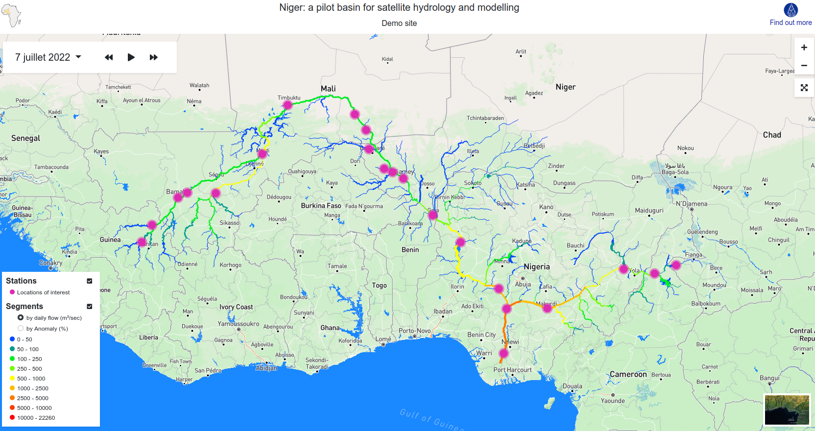
Implemented first in the Niger basin, this platform is intended to be deployed in other large river basins and to serve as a tool for monitoring variations in water resources, thus responding to SDG indicator 6.6.1 (change in the measurement of water-related ecosystems).

nous contacter observation terre magellium

hyfaa hydrologie magellium

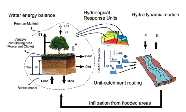
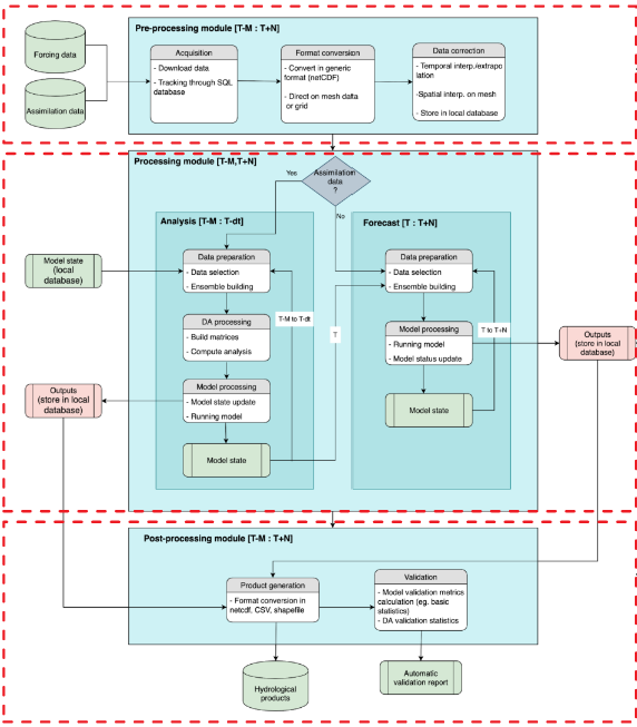
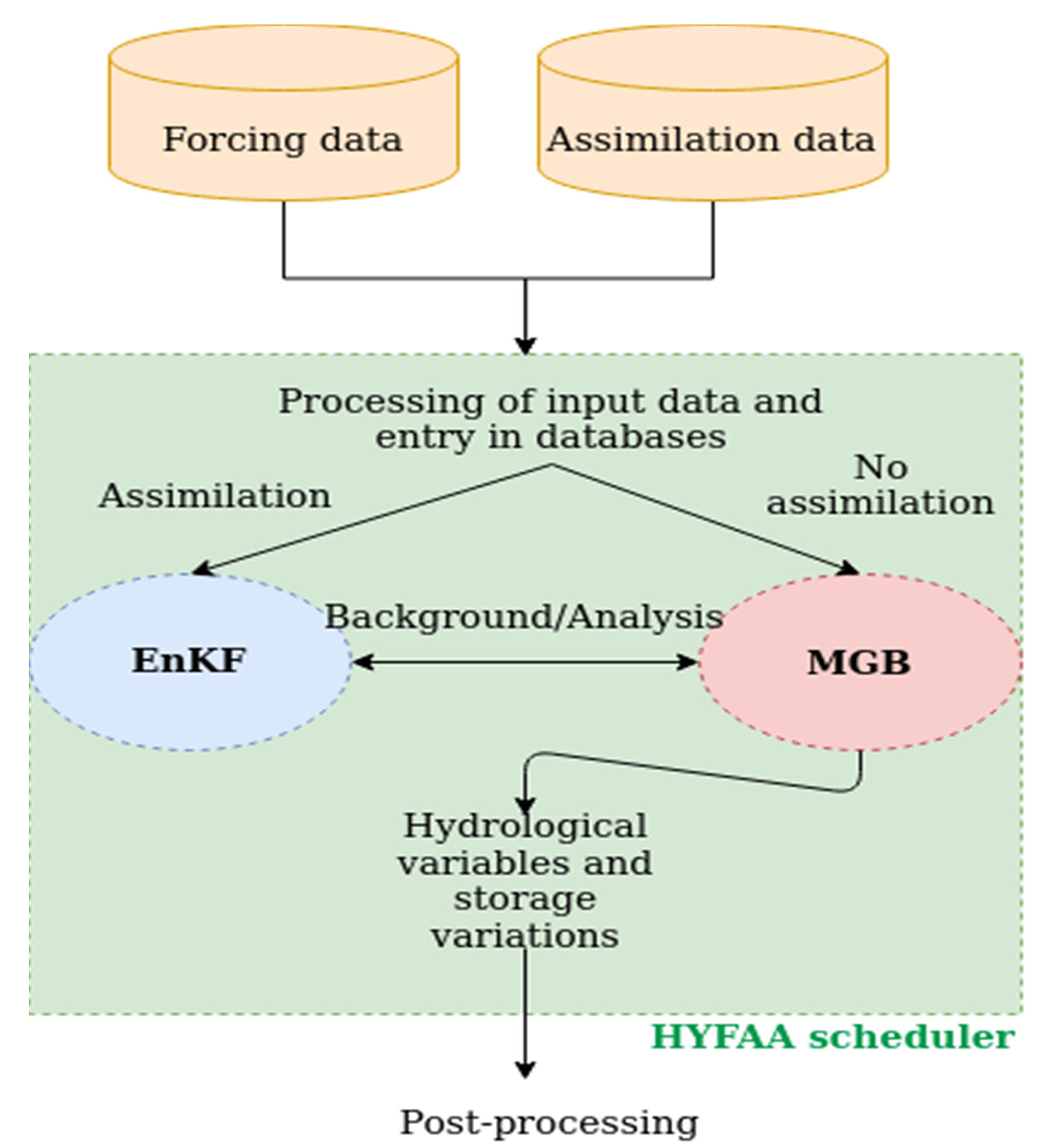
The semi-operational hydrological forecasting platform HYFAA provides the coupling between a large-scale hydrological model and an ensemble Kalman filter (EnKF). The hydrological model used is the MGB (Modelo de Gran Bacias) model developed in the Large Scale Hydrology Research Group of the University of Rio (Paiva et al., 2013). The ensemble Kalman filter (Eversen, 2003) is a stochastic method that corrects the model states and parameters with each acquisition of observed data.


HYFAA and its uses


        • MGB-HYFAA Niger : an experimental demonstrator for monitoring/predicting the flow at any point on the river. Project financed by CNES, carried out in collaboration with the Institut de Recherche pour le Développement (IRD) and the Niger Basin Authority (NBA).
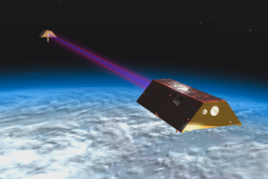
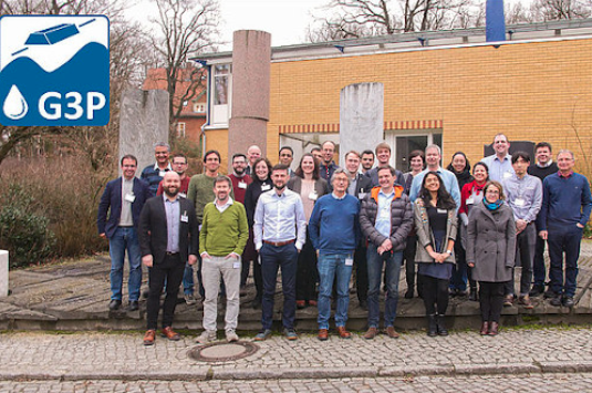
        • Global Gravity-based Groundwater product (G3P): l’Unité Observation de la Terre de Magellium is part of a consortium of 12 European partners in a project that aims to estimate groundwater stock variations (defined as an Essential Climate Variable by GCOS) through a combination of satellite data (GRACE, Sentinels) and models (Lisflood, HYFAA).
        • Helping the design of future altimetry missions: HYFAA is used in twin experiments (OSSE) to evaluate the impact of future satellite missions (SWOT, SMASH…) on hydrological forecasting and to determine the optimal data characteristics (error, orbit).

    Key partners

    Hydromatters, Géosciences Environnement Toulouse (GET), CNES, LEGOS, Niger Basin Authority

    Key words

    observation, satellite, earth, studies, hydrology, altimetry, niger, lake, river, water, ecosystem

    observation de la terre

    SCIENCE FOR EARTH CARE

    The Earth Observation Unit of Magellium  is an expert in optical space missions and geophysical and biophysical applications. The EO unit provides high level of expertise and full capacity on the whole processing chain, enabling it to respond to all projects from the greatest space orders such as ESA and CNES.

    Contact

    eo@magellium.fr

    +33 5 62 24 70 00

    1, rue Ariane
    31520 Ramonville Saint-Agne FRANCE

    More info

    www.magellium.com

    Follow us

    GSOOS

    GSOOS

    GSOOS

    Generic Simulator of Earth Observation Optical Sensors

    agence spatiale europenne esa

    Project

    Generic tool for the Simulation of Optical Earth Observation Sensors (GSOOS) and generation of L1B products

    U

    Skills

    Use of radiative transfer models, simulation of synthetic scenes

    Date

    From 2019 to today

    GSOOS project

    GSOOS (ESA/ESTEC) is a project to develop a generic tool capable of generating synthetic data for the design and validation of satellite missions in their initial phases. The simulator is capable of producing products representative of the outputs provided by an operational processor.

    The E2ES tools

    The development of end-to-end mission performance simulators (E2ES) started in the late 1980s with the advent of Earth observation satellite data.

    These tools aim to :

    1. dimensioning new optical instruments,

    2. tracing the link between user and instrument requirements through the flexibility of the parameterisation of geometry, scene and sensor models,

    3. develop and test data processing algorithms.


    GSOOS, an essential tool

    Currently, the implementation of a new satellite mission requires the development of an associated E2ES tool, which is an costly engineering process. In this context, ESA/ESTEC is promoting the development of a generic E2ES tool (GSOOS) capable of generating synthetic data for the design and validation of satellite missions in early phases. GSOOS is capable of producing products representative of the outputs provided by an operational processor.


    The role of Magellium

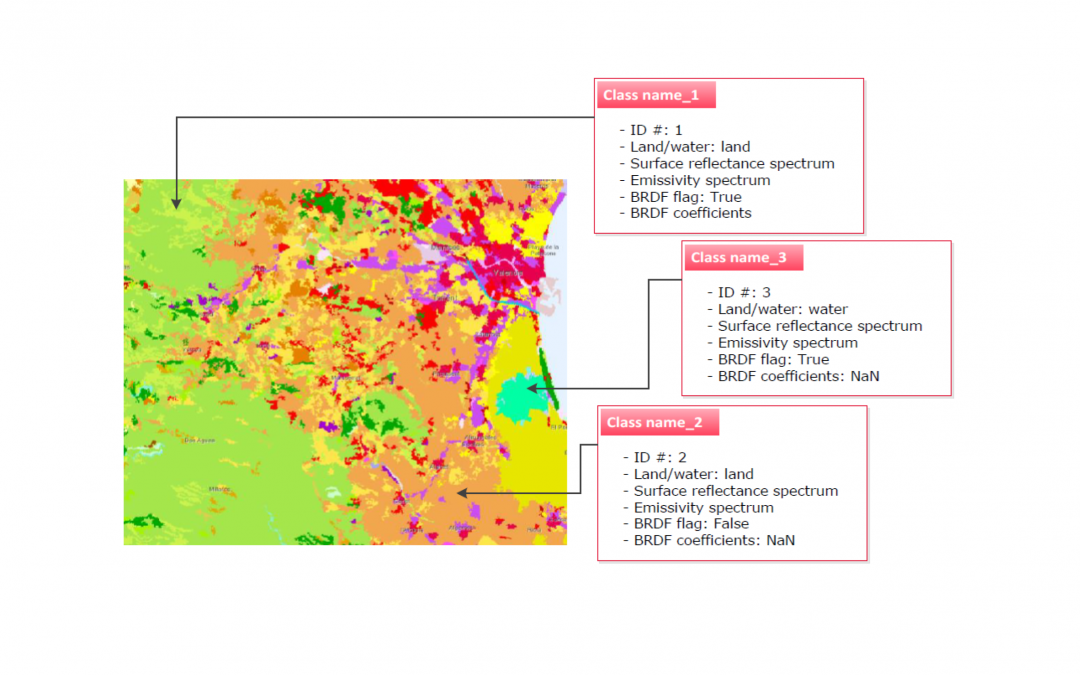
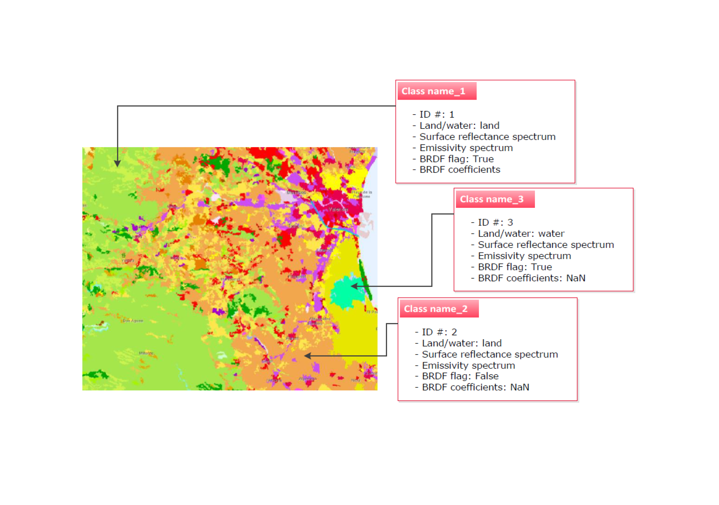
    The Earth Observation unit is responsible for the development of the synthetic scene simulator (SS). It’s a key component within an instrument simulator framework as it provides physically-realistic input stimuli of the targets observed by the satellite instruments. Also, this component allows to perform sensitivity assessments on the instrument configuration and Level 1 data processing.

    The objectives of GSOOS


        • Development of a generic end-to-end simulator for passive optical missions
        • Synthetic scene generator taking into account BRDF effects, solar glow, environmental effects, reflection and emissivity, etc, for wavelengths from visible (400 nm) to thermal (14 µm)
        • Radiative transfer modelling (MODTRAN) for various atmospheric conditions
        • Integration into the BIBLOS library
    gsoos esa magellium

    Key partners

    GMV Spain, Thalès Alenia Space France, GMV Poland

    Key words

    tool, data, end-to-end simulator, synthetic scenes, space mission, MODTRAN, BiBLOS

    observation de la terre

    SCIENCE FOR EARTH CARE

    The Earth Observation Unit of Magellium  is an expert in optical space missions and geophysical and biophysical applications. The EO unit provides high level of expertise and full capacity on the whole processing chain, enabling it to respond to all projects from the greatest space orders such as ESA and CNES.
    Contact

    eo@magellium.fr

    +33 5 62 24 70 00

    1, rue Ariane
    31520 Ramonville Saint-Agne FRANCE

    More info

    www.magellium.com

    Follow us

    RadCalNet

    RadCalNet

    RadCalNet

    The RADiometric CALibration NETwork
    Portail de données

    radcalnet projet observation terre magellium

    Product

    Development, maintenance and updates of the RadCalnet portal for ESA

    U

    Skills

    Radiometry, calibration

    Date

    From 2013 to today

    The RadCalNet portal


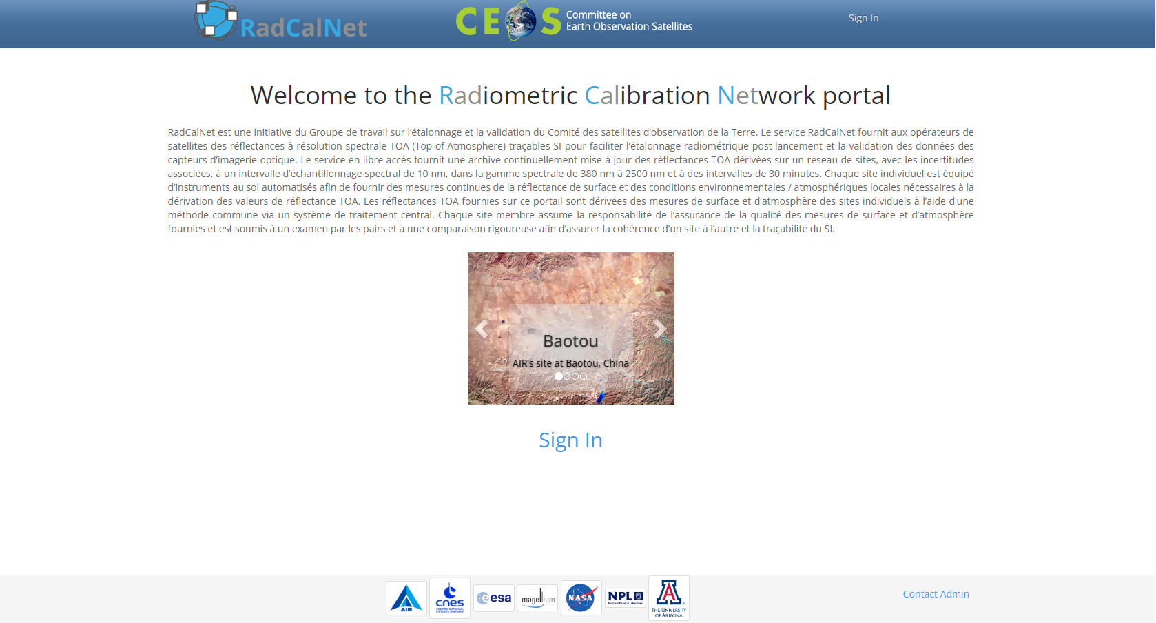
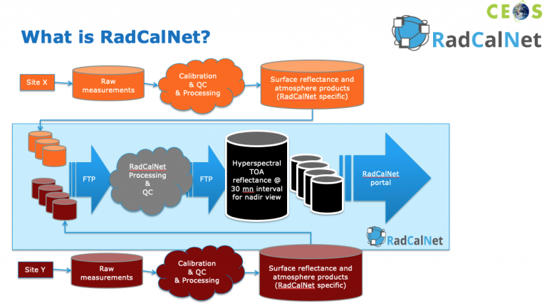
    RadCalNet is an initiative of the Working Group on Calibration and Validation of the Committee on Earth Observation Satellites. The RadCalNet service provides satellite operators with SI-traceable Top-of-Atmosphere (TOA) spectral resolution reflectances. This facilitates post-launch radiometric calibration and validation of optical imaging sensor data.

    The open access service provides a continuously updated archive of TOA reflectances derived over a network of sites, with associated uncertainties. These are collected at a spectral sampling interval of 10 nm, in the spectral range 380 nm to 2500 nm and at 30 minute intervals. Each individual site is equipped with automated ground-based instruments. These instruments provide continuous measurements of surface reflectance and local environmental/atmospheric conditions necessary to derive TOA reflectance values. The TOA reflectances, provided on this portal, are derived from the surface and atmospheric measurements of the individual sites. This is made possible by using a common method via a central processing system.

    Each member site takes responsibility for the quality of the surface and atmospheric measurements provided. Also, each member is subject to rigorous peer review and comparison. These checks ensure consistency from site to site and traceability of the SI.

    radcalnet esa magellium

    Web interface of the RadCAlNet tool

    The Earth Observation Unit is in charge of the development, maintenance and evolution of the portal. We have participated in many space missions in the framework of RadCalnet: Pleiades HR 1 & 2, CALIPSO, Sentinel-2A & 2B, CSO-1,2 (3 soon), METOP-C/IASI-C, PARASOL, Venms, Megha-Tropiques, Pleiades Neo.

    We have been awarded a label of excellence by CNES for our expertise in this field.

    The portal provides access to all RadCalNet data sets, allowing users to view and download data acquired by the four instrumented reference test sites.

    The portal can be accessed on the website RadCalNet.

    What we do :


        • development, maintenance and evolution of the portal
        • in-orbit calibration of space-based sensors
        • a dedicated acquisition plan
        • a set of geometric and radiometric calibration parameters to be downloaded on board
        • a configuration of the image processing chain on the ground


    The RadCalNet portal currently has :

        • 521 users including :
          • representatives of national space agencies
          • private operators of optical
          • space sensors
            universities
        • 2014 days available for calibration since March 2013
    radcalnet magellium portail

    Key partner

    ESA

    Key words

    calibration, radiometry, portal, sensor, space, optical, reflectance, CEOS

    observation de la terre

    SCIENCE FOR EARTH CARE

    The Earth Observation Unit of Magellium  is an expert in optical space missions and geophysical and biophysical applications. The EO unit provides high level of expertise and full capacity on the whole processing chain, enabling it to respond to all projects from the greatest space orders such as ESA and CNES.
    Contact

    eo@magellium.fr

    +33 5 62 24 70 00

    1, rue Ariane
    31520 Ramonville Saint-Agne FRANCE

    More info

    www.magellium.com

    Follow us

    PICSCAR

    PICSCAR

    PICSCAR

    Portal on the characterisation of pseudo-invariant calibration sites

    picscar magellium observation terre

    Mission

    Prioritise research on Pseudo-Invariant Calibration Sites (PICS) and their use

    Instruments

    Optical sensor PARASOL

    U

    Skills

    Radiometry

    Date

    From 2016 to today

    The PICSCAR tool


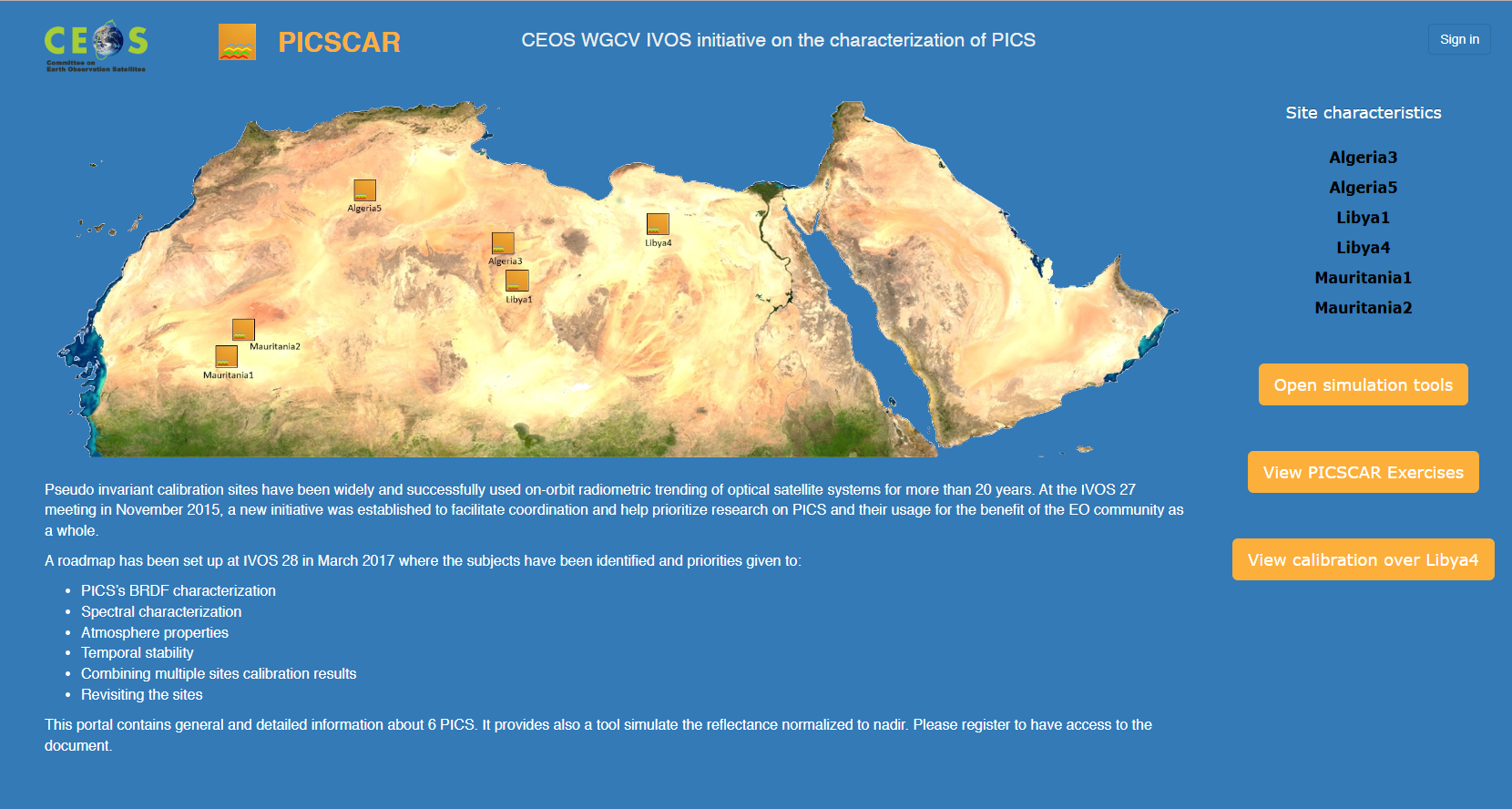
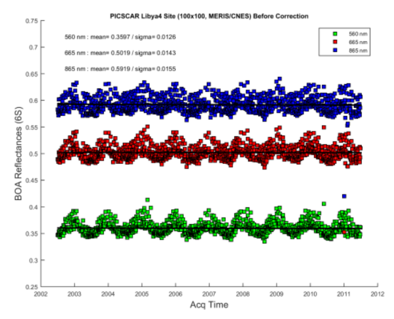
    PICSCAR is used to establish the intercalibration results. These results are obtained operationally by the different teams using their own data extraction and processing. These results are then made available to users via PICSCAR.

    The results of the intercalibration of L8 OLI against S2A MSI are uploaded every 6 months on the PICSCAR website.

    nous contacter observation terre magellium

    picscar outil magellium

    Web interface of the PICSCAR tool

    The objectives of PICSCAR


          • BRDF
          • Spectral characterisation
          • Properties of the atmosphere
          • Temporal stability
          • Combining calibration results from several sites
          • Re-examination of sites
      picscar outil magellium

      Key partners

      CNES, Committee on Earth Observation Satellites (CEOS)

      Key words

      radiometry, tool, calibration, intercalibration, portal

      observation de la terre

      SCIENCE FOR EARTH CARE

      The Earth Observation Unit of Magellium  is an expert in optical space missions and geophysical and biophysical applications. The EO unit provides high level of expertise and full capacity on the whole processing chain, enabling it to respond to all projects from the greatest space orders such as ESA and CNES.

      Contact

      eo@magellium.fr

      +33 5 62 24 70 00

      1, rue Ariane
      31520 Ramonville Saint-Agne FRANCE

      More info

      www.magellium.com

      Follow us

      DIMITRI

      DIMITRI

      DIMITRI

      Database for Imaging Multi-spectral Instruments and Tools for Radiometric Intercomparison

      Mission

      Database for multispectral imaging instruments and tools for radiometric intercomparison

      Instruments

      Various optical sensors : SPOT, ERS-2, AQUA, PARASOL, ENVISAT

      U

      Skills

      Sensor radiometry, radiometric measurements

      Date

      From 2014 to today

      DIMITRI project


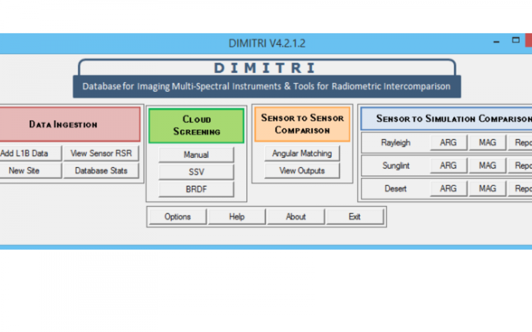
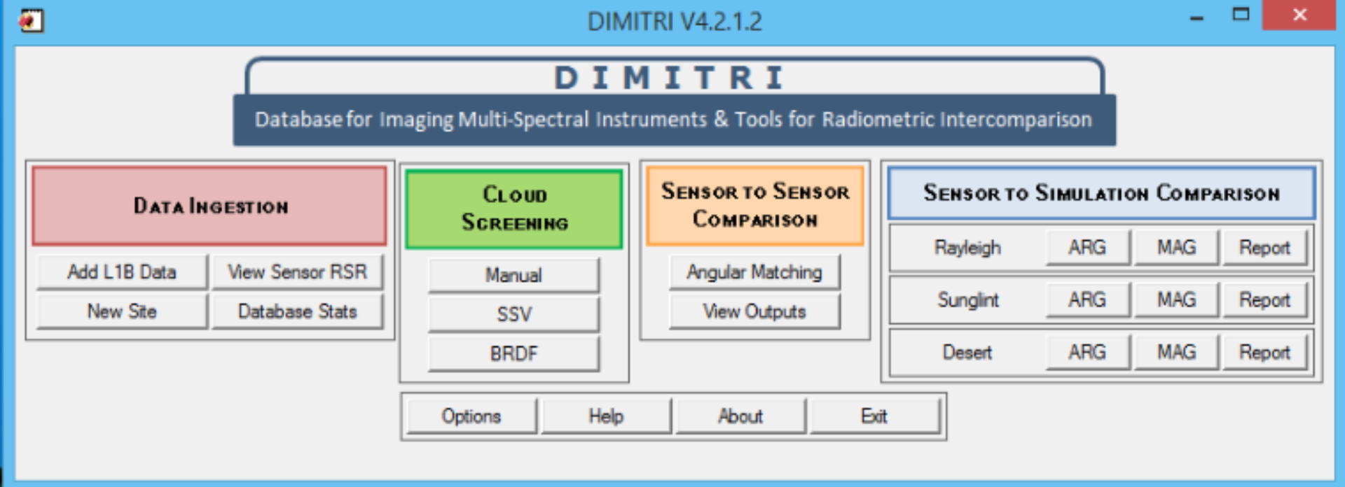
      DIMITRI is a tool developed to check the radiometry of sensors using ground targets that have stable radiometric properties. This tool manages a database containing the level 1 radiometric measurements of different optical sensors: MERIS, MODIS, AATSR, AATSR2, S2A, OLCI, PARASOL, VEGETATION, etc. In addition, the DIMITRI tool allows intercomparisons to be made from the selection by using a reference sensor.

      dimitri magellium

      DIMITRI can be used for intercomparison of TOA radiance and reflectance values in the 400nm – 4μm wavelength range. This is generally known as Level 1b Earth Observation (EO) satellite data.


      Learn more about the DIMITRI tool here.

      nous contacter observation terre magellium

      The objectives


      DIMITRI’s features are the followings:

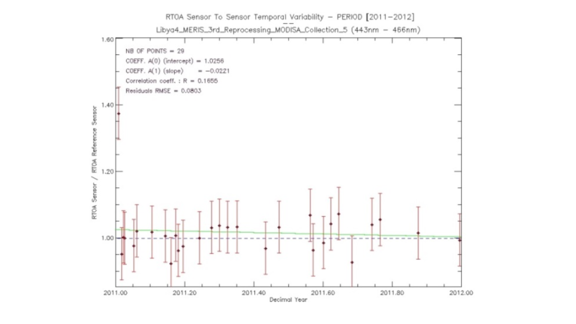
      Sensor-to-sensor comparison

      Sensor-to-simulation comparison

      Based on radiative transfer simulations of TOA reflectances for

      Rayleigh

      Sunglint

      Desert

      On different sites:

      Desert

      Sunglint

      Ocean

      Cloud

      Snow

      dimitri magellium

      Key partners

      ESA, ARGANS

      Key words

      tool, radiometry, sensor, data, imagery, multispectral, SPOT, ERS-2, AQUA, PARASOL, ENVISAT

      observation de la terre

      SCIENCE FOR EARTH CARE

      The Earth Observation Unit of Magellium  is an expert in optical space missions and geophysical and biophysical applications. The EO unit provides high level of expertise and full capacity on the whole processing chain, enabling it to respond to all projects from the greatest space orders such as ESA and CNES.

      Contact

      eo@magellium.fr

      +33 5 62 24 70 00

      1, rue Ariane
      31520 Ramonville Saint-Agne FRANCE

      More info

      www.magellium.com

      Follow us