Merlin

Merlin

Merlin

Methane Remote Sensing Lidar Mission
Soutien technique pour le CNES

cnes centre national etudes spatiales observation terre

Mission

Measure the concentration of methane in the atmosphere and identify the sources of this greenhouse gas

Instrument

LIDAR IPDA

U

Skills

Radiometry, signal processing, radiative transfer

Date

From 2003 to today
Expected launch date 2027

The MERLIN project


Methane is a major contributor to climate change. Indeed, one tonne of methane contributes 25 times more to climate change than one tonne of CO2 on a time scale of 100 years. It is produced both by natural and human actions. However, its production remains largely linked to human activities. Indeed, its quantity has doubled since the beginning of the industrial era.
This is why it is essential to accurately measure the amount of atmospheric methane in order to understand the workings of our climate.
projet merlin cnes magellium changement climat

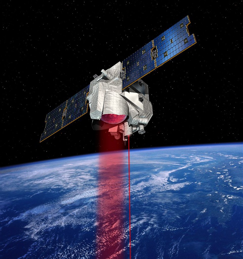
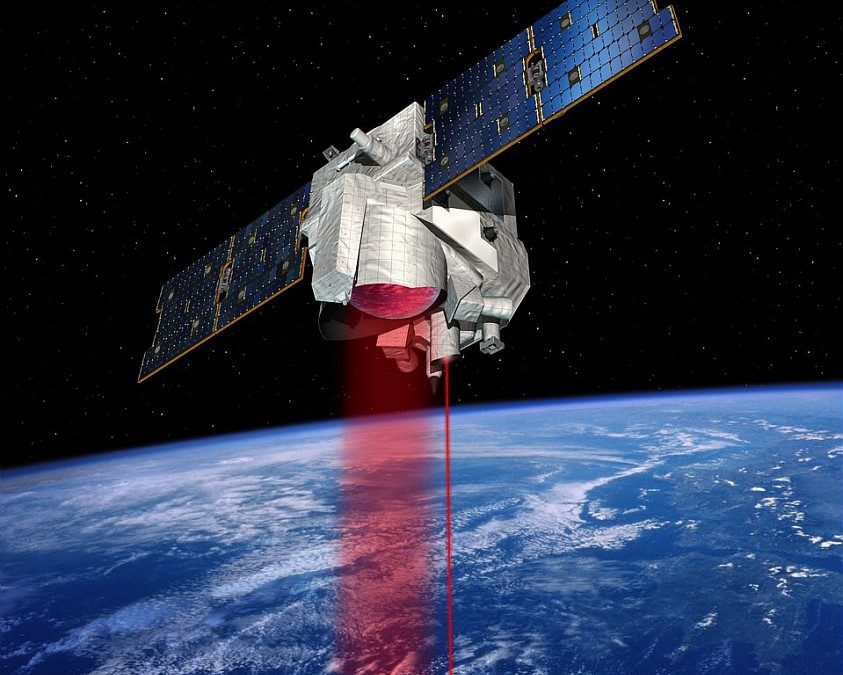
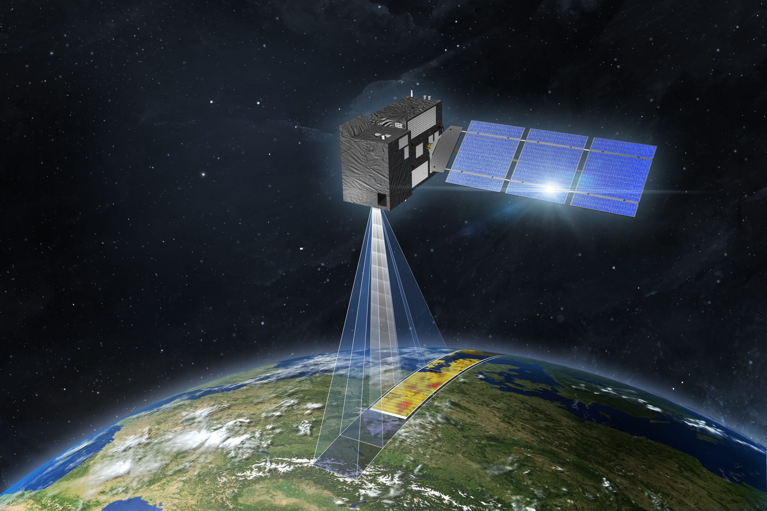
Illustration of the MERLIN satellite
© CNES/ill./DUCROS David, 2016

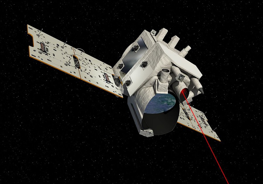
To carry out these measurements, the Merlin satellite uses a method that allows for unequalled precision. It will be equipped with the LIDAR IPDA for Integrated Path Differential Absorption. Its launch is scheduled for 2024. This mission is being developed jointly by the French CNES and German DLR space agencies.

The unit contributes to the definition of the algorithm of the processing chain, tests and validates the performance assumptions. It also carries out scientific studies on the geophysics of the measurement, and participates in the creation of an orbital simulator for any LIDAR IPDA satellite.

Learn more about the MERLIN mission on the CNES website.

nous contacter observation terre magellium

The objectives


    Part of the unit is based at the CNES premises in order to better respond to the project.

    The objective of the MERLIN project is to accurately measure the amount of methane in the atmosphere and to know its sources. To achieve this, our activity is based on these essential points:


    geometric model: L1 first geolocation

    preparation for validation

    modelling the spatio-temporal variability of methane

    comparison of weighting functions with TCCON

    estimation of the SNR in flight

    projet merlin cnes magellium changement climat

    Illustration of Merlin satellite
    © CNES/DUCROS David, 2016

    Key words

    observation, satellite, earth, studies, climate change, methane, greenhouse gases, ground segment, LIDAR, geometric modeling

    observation de la terre

    SCIENCE FOR EARTH CARE

    The Earth Observation Unit of Magellium  is an expert in optical space missions and geophysical and biophysical applications. The EO unit provides high level of expertise and full capacity on the whole processing chain, enabling it to respond to all projects from the greatest space orders such as ESA and CNES.
    Contact

    eo@magellium.fr

    +33 5 62 24 70 00

    1, rue Ariane
    31520 Ramonville Saint-Agne FRANCE

    More info

    www.magellium.com

    Follow us

    METImage

    METImage

    METImage

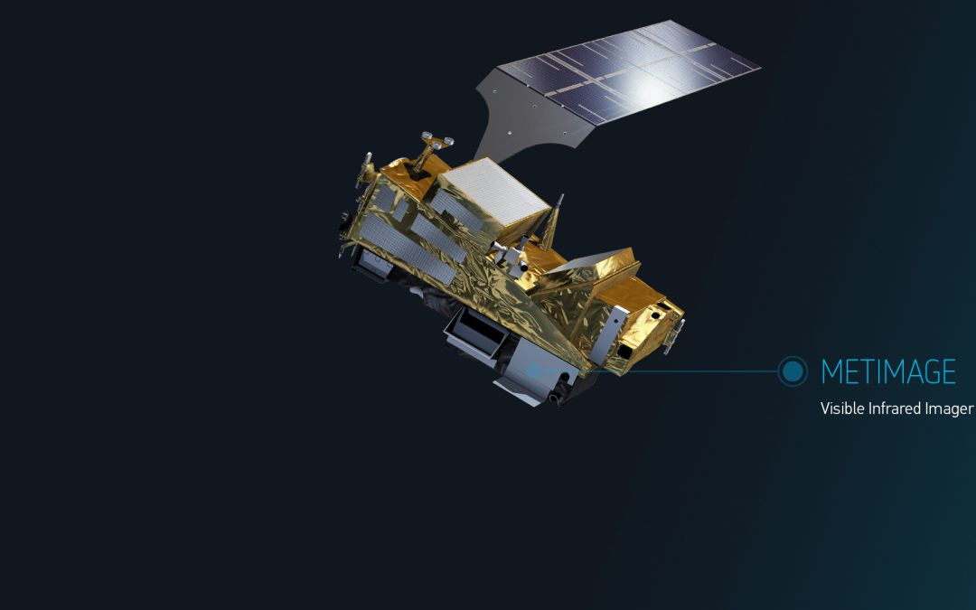
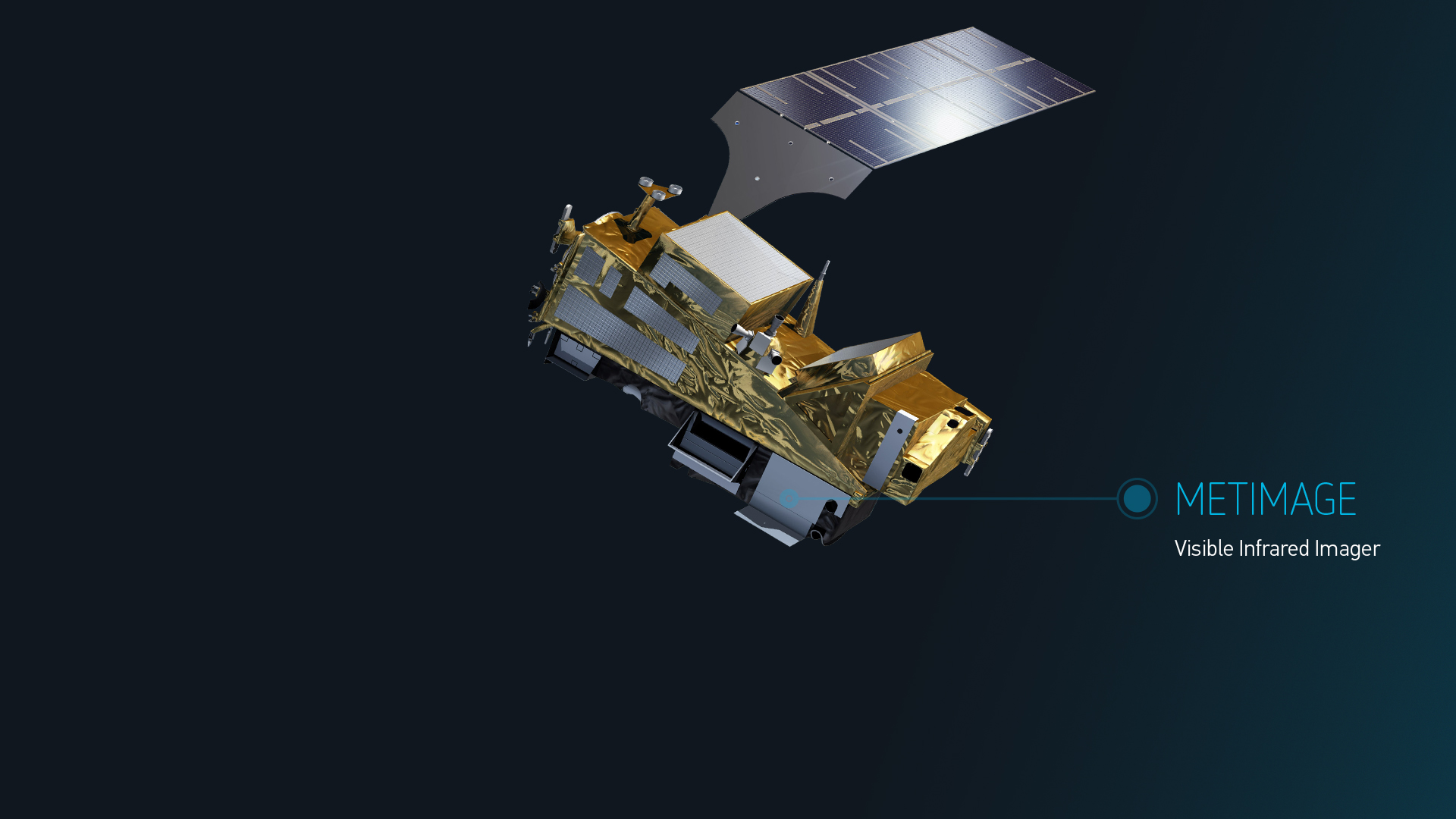
    METImage (acronym VII) is an imaging instrument on the Metop-SG A satellite

    Mission

    Design and development of the METImage data processing chain (as part of PDAP – processing chain for all Metop-SG instruments)

    Satellites / Instruments

    Metop-SG A satellite carrying 6 instruments including METImage (VII)

    U

    Skills

    Stereo-restitution, Java programming language, spectral calibration, data processing, radiometry

    Date

    From 2018 to today

    The Metop-SG A and Metop-SG B satellites


    Metop-SG A and Metop-SG B are the two types of multi-instrument satellites that make up the EUMETSAT EPS-SG. They operate in the same orbit with different configurations. The benefits or applications of this mission are focused on weather forecasting, climate change, air quality (atmospheric composition), hydrology, oceanography, etc. Metop-SG A is also the satellite with the 3MI instrument.

    The METImage mission

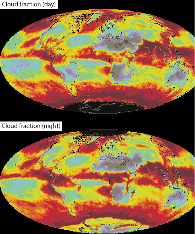
    MetImage (VII) is one of the instruments on Metop-SG A. It is a visible and infrared imager developed by DLR. It provides information on clouds, cloud cover, surface characteristics, ground temperature, ice and surface water. This is made possible by:

        • a large number of spectral channels to measure more variables
        • higher spatial sampling (500 m): more complete coverage
        • better radiometric resolution for more accurate quantification

    The EUMETSAT HQ MCC (Mission Control Centre) is composed, among others, of the PDAP (Payload Data Acquisition and Processing) in charge of the acquisition and processing of instrument data, in particular from VII.

    segment sol observation terre PDAP MetImage magellium

    Illustration du satellite METOP-SG A
    © EUMETSAT

    The unit is in charge of implementing the PGFs (Processing Generation Functions) of instrument VII in the PDAP processing chains. This processing allows the generation of L1B and L2CM level products:

        • L1B (level 1B): calibrated and navigated radiances in 20 spectral channels at 500 m sampling
        • L2CM (level 2 cloud mask)

    More details on the MetImage mission can be found on the EUMETSAT website.

    The objectives


    Operational perimeter at ground segment level : 

        • Design and implementation of PGFs for the METImage instrument allowing the generation of L1B and L2CM products

        • Integration into the complete and operational processing chains (PDAP)

        • Validation using data generated by GPP VII
    metimage nuage magellium observation terre

    Consortium

    EUMETSAT, Thales

    Key words

    observation, satellite, ground segment, METImage, VII, PDAP, climate, EUMETSAT, METOP-SG

    observation de la terre

    SCIENCE FOR EARTH CARE

    The Earth Observation Unit of Magellium  is an expert in optical space missions and geophysical and biophysical applications. The EO unit provides high level of expertise and full capacity on the whole processing chain, enabling it to respond to all projects from the greatest space orders such as ESA and CNES.
    Contact

    eo@magellium.fr

    +33 5 62 24 70 00

    1, rue Ariane
    31520 Ramonville Saint-Agne FRANCE

    More info

    www.magellium.com

    Follow us

    CO2M

    CO2M

    CO2M

    Copernicus Anthropogenic Carbon Dioxide Monitoring

    copernicus magellium

    Mission

    First mission to measure the amount of carbon dioxide released into the atmosphere by human activity

    Satellites / Instruments

    Sentinel 7A and Sentinel 7B satellites (in 2025) carrying CO2I, MAP and CLIM instruments

    U

    Skills

    Simulation of the telemetry of the 3 CO2M instruments (CO2I, MAP, CLIM), L0 product generation and geometry module

    Date

    From 2020 to today

    The CO2M project


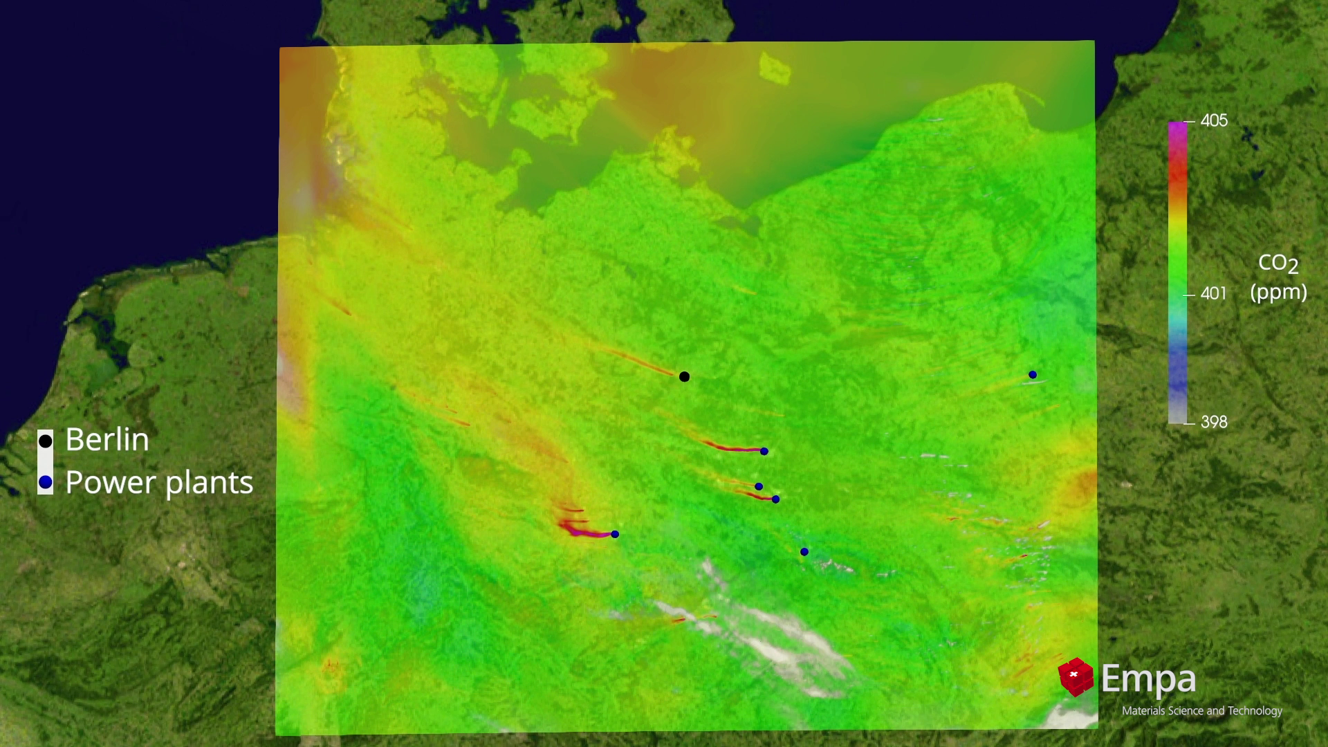
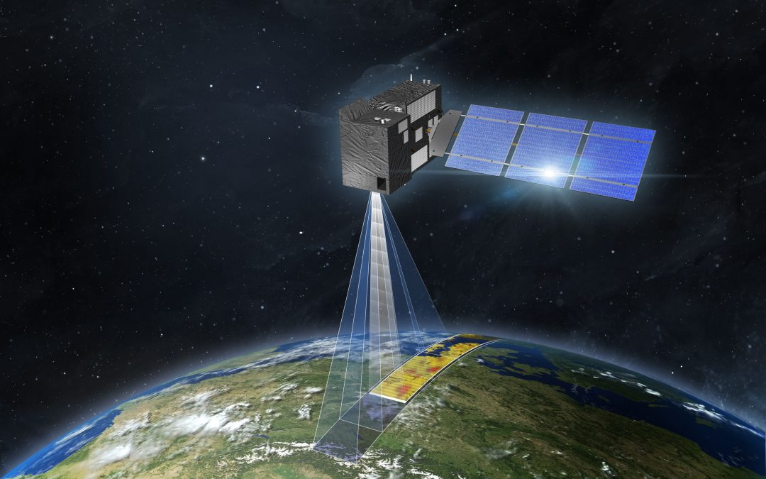
    The amount of carbon dioxide in the Earth’s atmosphere is approaching a level that humans may never have experienced before. The Copernicus Carbon Dioxide Monitoring Mission (CO2M) is now more than ever needed.

    This is the first mission to measure the amount of carbon dioxide released into the atmosphere by human activity. The data collected by CO2M will be used to help monitor and implement the targets set in the Paris Agreement.

    le segment sol de l'observation de la terre CO2M magellium

    Illustration du satellite / © ESA

    The CO2M mission includes the launch of two identical satellites (Sentinel 7A and 7B) by the end of 2025.

    In addition, CO2M follows the Sentinel missions of the EU’s Copernicus environmental monitoring programme. This programme is the largest provider of Earth observation data in the world.

    For more information, see the ESA article and its website for CO2M.

    nous contacter observation terre magellium

    The objectives


    • Development of prototype ground segment modules: simulation of the telemetry of the 3 instruments (CO2I, MAP, CLIM)


    • Generation of L0 products and geometry module for the generation of level 1 products
    dioxyde carbone co2m magellium

    Simulated data showing carbon dioxide plumes / © ESA

    Consortium

    ESA, EUMETSAT, OHB, Thales

    Key words

    observation, satellite, earth, studies, carbon dioxide, CO2, activity, human, copernicus, sentinel, atmosphere, climate

    observation de la terre

    SCIENCE FOR EARTH CARE

    The Earth Observation Unit of Magellium  is an expert in optical space missions and geophysical and biophysical applications. The EO unit provides high level of expertise and full capacity on the whole processing chain, enabling it to respond to all projects from the greatest space orders such as ESA and CNES.
    Contact

    eo@magellium.fr

    +33 5 62 24 70 00

    1, rue Ariane
    31520 Ramonville Saint-Agne FRANCE

    More info

    www.magellium.com

    Follow us

    LibGEO

    LibGEO

    LibGEO

    Library for Expert and Operational Geometry

    libgeo cnes magellium observation terre

    Product

    Geometric modelling library for Earth observation sensors

    Satellites / Instruments

    Pleiades, Pleiades NEO, Sentinel-2 L1B, CO3D, TRISHNA, 3MI, METImage, Metop SG, MicroCarb

    U

    Skills

    Geometry, in-orbit calibration, prototyping, study, geometric correction

    Date

    From 1995 to today

    The LibGEO product


    LibGEO is the new reference multi-sensor geometric modelling library of CNES (Centre National d’Etudes Spatiales). It is designed for the rigorous geometric modelling of Earth observation sensors. Indeed, this modelling allows to build a line of sight and to intersect with an Earth model (ellipsoid, Digital Elevation Model, geoid…). In addition, LibGEO provides a large number of tools to exploit and improve the geolocation of satellite images.

    This library is the result of more than 20 years of continuous improvement and R&D. This product was designed in collaboration with CNES and IGN (French National Geographic Institute).

    This product supports several sensors:

        • Pleiades and Pleiades NEO
        • Sentinel-2 L1B
        • CO3D
        • TRISHNA
        • 3MI, METImage, Metop SG
        • MicroCarb
        • Generic sensors, other sensors can be easily supported regardless of their nature (push-broom, frame camera, whiskbroom…)
    libgeo cnes magellium

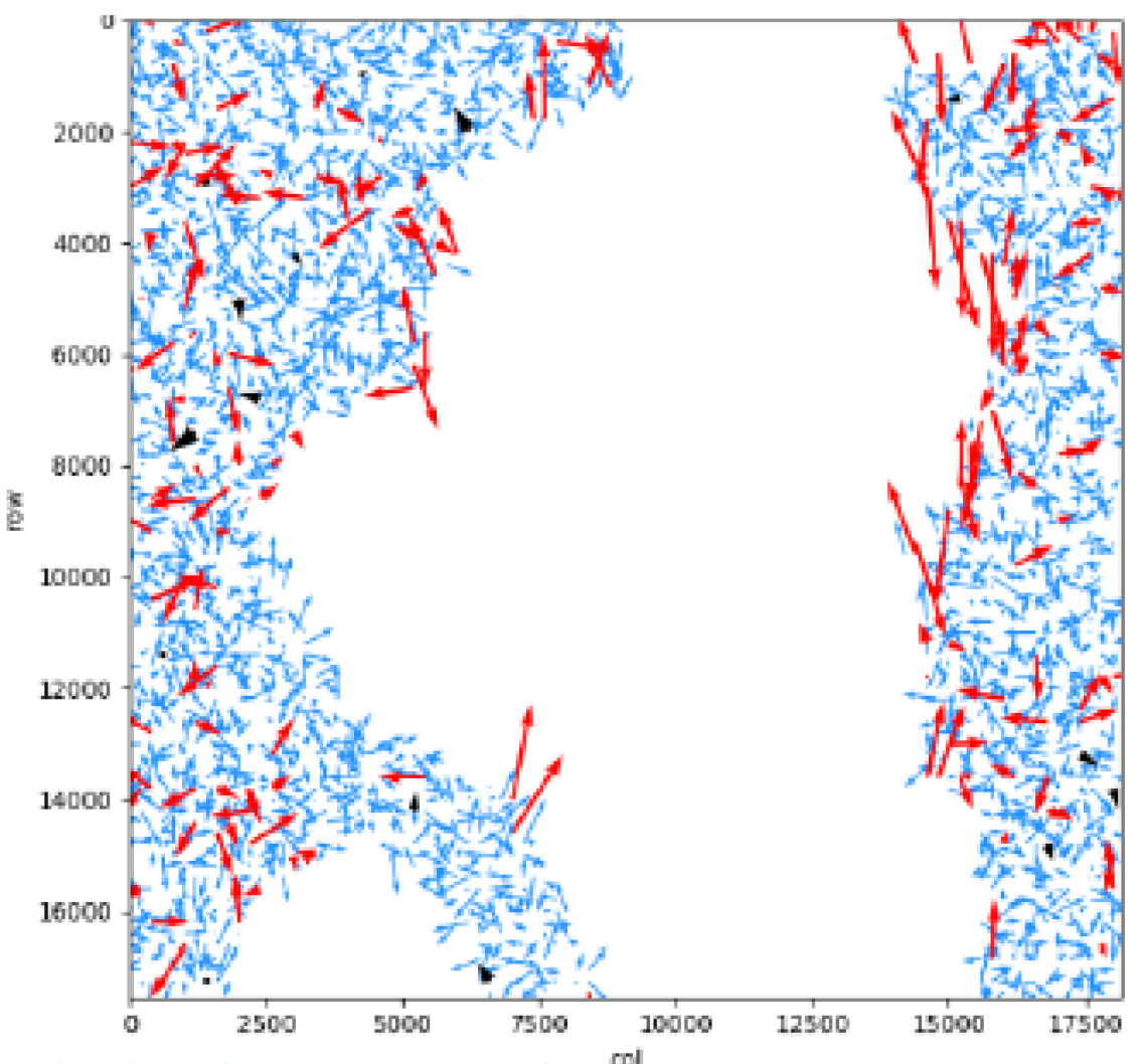
    Residuals of the junction points, after refining the geometric parameters. Red arrows have been marked as anomalies and filtered out, while blue arrows are correct.

    The Earth Observation Unit is responsible for developing and editing the software on behalf of the CNES. Beyond modelling, LibGEO allows for the optimisation of physical parameters in order to improve localisation based on exogenous observations, generally obtained by a correlator or ground control points.

    nous contacter observation terre magellium

    The properties of LibGEO


      Les features :

          • Rigorous line of sight modelling

          • RPC and grid modelling

          • Direct (image>ground) and inverse (ground>image) localisation and collocation (image1>image2), intersection on digital elevation models

          • Grid resampling between geometries (image, ground, epipolar)

          • Optimisation of acquisition parameters (attitude, ephemeris…) using Ground Control Points and image correlation to improve geolocation

          • Outlier filtering

          • Geometry for stereo reconstruction

          • Serialization to disk of visualization models in XML format


      The services available :

          • Distribution, corrective, adaptive and evolutionary maintenance, support
          • Expertise & consulting and studies
          • Customised development: new sensors, geometric correction chain, dedicated tools, etc.

      The architecture :

          • Open, scalable, cloud-compatible C++ library
          • Extensive Python API, handy with tutorials
          • Available on Linux CentOs7, portable
      libgeo cnes magellium

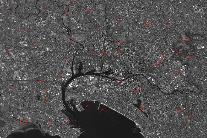
      Optimisation of the visualisation model

      Key partners

      French Centre National d’Etudes Spatiales (CNES) and Institut Nation de l’Information Géographique et Forestière (IGN)

      Key words

      observation, satellite, earth, studies, LibGEO, library, modelling, geometry, sensor, CNES, software, finished product, Pleiades Neo, Sentinel, CO3D, Trishna, 3MI, METImage, Metop, MicroCarb, Euclidium, refinement, expertise, localisation, image

      observation de la terre

      SCIENCE FOR EARTH CARE

      The Earth Observation Unit of Magellium  is an expert in optical space missions and geophysical and biophysical applications. The EO unit provides high level of expertise and full capacity on the whole processing chain, enabling it to respond to all projects from the greatest space orders such as ESA and CNES.

      Contact

      eo@magellium.fr

      +33 5 62 24 70 00

      1, rue Ariane
      31520 Ramonville Saint-Agne FRANCE

      More info

      www.magellium.com

      Follow us

      H2020 G3P

      H2020 G3P

      H2020 G3P

      Global product of variation of groundwater volumes based on gravimetry
      copernicus magellium

      Mission

      Develop a groundwater volume variation product for the Copernicus service

      Satellites / Instruments

      GRACE and GRACE-FO

      HYFAA

      Copernicus Services

      U

      Skills

      Processing of gravity data

      Use of existing Copernicus services

      Hydrological modelling

      Date

      From 2020 to today

      H2020 G3P project


      Groundwater is one of the most important freshwater resources for humans and ecosystems. Because of its fundamental role in the Earth’s water and energy cycles, groundwater has been declared an essential climate variable (ECV) by GCOS, the Global Climate Observing System.

      An ECV is a variable that is essential for characterising the climate system and its changes. ECV data provide the empirical evidence needed to understand and predict climate change, assess risks, guide adaptation measures, underpin climate services, etc.

      However, Copernicus services do not yet provide data on groundwater variations. Nor are there any other data sources in the world that provide, in an operational and consistent manner, information on this variable based on observations and with global coverage. This gap will be filled by G3P, the Global Gravity-based Groundwater Product, which estimates groundwater volume changes using a linear operation involving the main continental reservoirs (Güntner et al., 2007):

      nous contacter observation terre magellium

      magellium g3p bilan d'eau

      The Earth Observation unit is in charge of producing water volume variations in rivers using the HYFAA platform, which assimilates altimetry data. For more details on the HYFAA platform, click here.

      For more information on G3P project, click here.

      The objectives of G3P


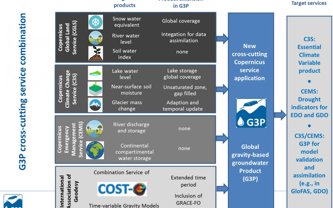
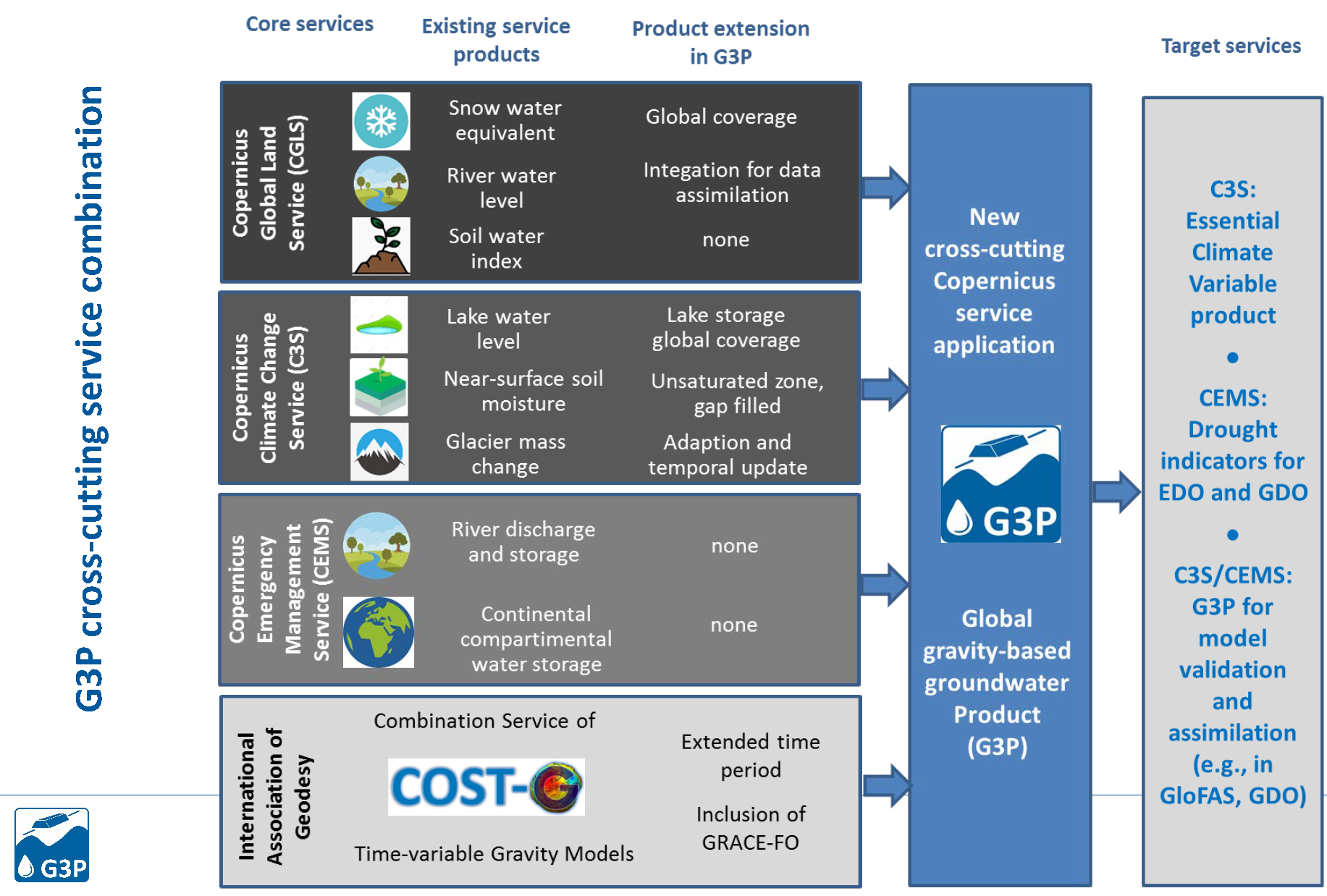
            • Process and make available the latest satellite gravity data (GRACE / GRACE-FO) as continental water stock products
            • Make G3P a cross-cutting application using a wide variety of the existing product portfolio of the three core Copernicus services
            • To evolve the existing Copernicus services products to meet the requirements of G3P development
            • Develop and evaluate a G3P-based groundwater drought index, with a use case for southern Spain
            • Assessment of global groundwater resources and the status of large aquifers around the world
            g3p hydrologie magellium

            Key partners

            University of Bern, CLIMERS, CLS, University of Zurich, EODC GmbH, Finnish meteorological Institute, Future Water SL, GFZ, IGRAC, Geodesy Institute, LEGOS

            Key words

            observation, satellite, earth, studies, hydrology, quality, water, groundwater, copernicus, g3p, climate change, cryosphere, gravimetry

            observation de la terre

            SCIENCE FOR EARTH CARE

            The Earth Observation Unit of Magellium  is an expert in optical space missions and geophysical and biophysical applications. The EO unit provides high level of expertise and full capacity on the whole processing chain, enabling it to respond to all projects from the greatest space orders such as ESA and CNES.
            Contact

            eo@magellium.fr

            +33 5 62 24 70 00

            1, rue Ariane
            31520 Ramonville Saint-Agne FRANCE

            More info

            www.magellium.com

            Follow us