
Environmental applications and climate change
We process Earth observation data into geophysical products and operational services dedicated to environmental monitoring and climate change analysis.
Our activities involve the combined processing of data from optical, altimetric and gravimetric missions to produce reliable, accurate indicators that can be directly utilised by scientists and institutions.
Turning scientific research into operational solutions
We support space and environmental agencies in making the most of Earth observation data by developing L3 and L4 products, as well as high-value-added thematic services in fields such as climate, oceanography and hydrology.
Our approach aims to transform scientific research findings into operational solutions integrated into large-scale monitoring systems. As such, we actively contribute to the European Copernicus Programme, which provides benchmark environmental information based on satellite, in situ and numerical model data.
Climate
We develop and operate products that enable the monitoring of key climate variables, including:
- rising mean sea level
- ocean mass and circulation
- the thermal content of the oceans
- the Earth’s global energy balance
This work contributes to a better understanding of the climate system and to the assessment of its long-term changes.
Hydrology
We have recognised expertise in the analysis of land surfaces, covering both physical and biogeochemical processes.
Our activities include:
- the production of high-spatial-resolution snow and ice products for the Copernicus Land service, using data from the Sentinel-1 and Sentinel-2 missions
- the assimilation of observation data from Sentinel-3 into large-scale hydrological models
- the development of hydrological indicators for monitoring water resources
Quality of inland and coastal waters
We produce water quality parameters using high-resolution satellite data, notably from Sentinel-2 and the Landsat programme.
These products enable the monitoring of:
- the physico-chemical quality of waters
- the ecological status of aquatic environments
- and biodiversity dynamics in inland and coastal areas

We transform Earth observation data into reliable environmental and climate indicators by developing operational products and services for global monitoring.
Contact us
Our Expertise
Data integration
Data analysis
Prototyping
Development of operational data processing pipelines
Key projects
Copernicus High Resolution Water, Snow & Ice for the EEA
Under a mandate from the EEA, we operate a sustainable, operational, high-resolution pan-European snow and ice service based on Sentinel-1 and Sentinel-2.
The products are delivered in real time across Europe. Furthermore, they provide information on fractional snow cover, snow conditions, the permanent snow line, water quantity and quality, and the extent of ice on rivers and lakes.
The Copernicus Snow and Ice Service builds on existing initiatives such as “Theia”, supported by Cesbio and CNES, and our other partners FMI, ENVEO and Astri Polska.
Find out more here.

L1C over Poland
4DATLANTIC for ESA
ESA’s MOHeaCAN project has successfully explored the possibility of monitoring the ocean’s overall heat content (OHC) using Earth observation (EO) data (altimetry – gravimetry). This was the first time that changes in global OHC and changes related to the Earth’s energy imbalance (EEI) had been estimated using space-based observations.
The aim of the 4DAtlantic-OHC project is to focus on the Atlantic Ocean. MOHeaCAN offers the opportunity to extend this work to the regional scale, where new challenges must be addressed. Indeed, a series of processes and parameters (coastal zone, mixed layer variability, etc.) that could be overlooked at the global scale can no longer be ignored at the regional scale. We must therefore explore the capabilities of in-situ observation missions and in-situ-based products in terms of spatial and temporal resolution for monitoring regional OHC in the Atlantic Ocean. Furthermore, we need to develop an appropriate framework to characterise and then propagate the uncertainty of input measurements. In this way, we will be able to derive reliable uncertainties for the final estimate of regional OHC.
Find out more here.

MOTECUSOMA for ESA
This project aims to improve our understanding of the global energy cycle and its dynamics in the context of human-induced climate change. Satellite climate data records developed as part of ESA’s Climate Change Initiative will enable us to estimate the Earth’s energy balance and surface air temperature, and to analyse their mean, trend and variability over the last three decades.
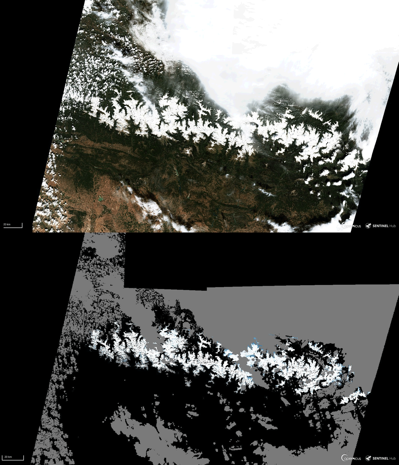
Example of processing applied by our team on a raw image from Sentinel-2 for the Snow&Ice programme.
© European Union, Copernicus Land Monitoring Service 2021, European Environment Agency



Our other expertises

Sensor geometry
We work with images acquired by Earth observation satellites. We build, optimise and use a geometric model of Earth Observation sensors.

Measurement Physics and Radiometry
Our expertise covers image quality, measurement physics and radiometry in the optical domain. This includes equalisation, stray light correction, absolute calibration, etc.

Ground segment
We provide Image Ground Segments for Earth Observation satellites, developing the processing chains, the orchestration, the cataloguing and archiving of the image products, including instrument simulation and ground-based processing prototypes.
Thematic Applications
We carry out scientific studies, manage projects on value-added products (L3/L4) and provide services in various thematic fields.

Space Surveillance
We have developed expertise and solutions for the detection and tracking of space objects (satellites and debris), from the ground or on board satellites.

SCIENCE FOR EARTH CARE
Magellium Artal Group’s Earth Observation unit provides expertise in optical space missions and geophysical and biophysical applications. The unit delivers a high level of expertise and complete control over the entire data processing chain, enabling it to meet the requirements of all projects for major space agencies such as ESA and CNES.