Trishna

Trishna

Trishna

Thermal infraRed Imaging Satellite for High-resolution Natural resource Assessment
Soutien technique pour le CNES

cnes centre national etudes spatiales observation terre

Mission

Mesurer la température de surface de l’ensemble du globe terrestre

Satellite / Instruments

Satellite Trishna

TIR (Thermal InfraRed)
VNIR/SWIR (Visible and Near InfraRed/Short Wave InfraRed)

U

Compétences

Modélisation géométrique

Date

Date de lancement prévue en 2025

Le projet Trishna


La végétation joue un rôle important dans le fonctionnement de la surface terrestre car elle régule les échanges d’énergie et de substances (CO2, H2O, etc.). Des capteurs visibles ont permis de suivre l’évolution (croissance, maturité, vieillissement) de la végétation depuis l’espace. Cependant, les plantes peuvent souffrir de stress hydrique, ce qui élève la température des plantes. Cette tension peut être observée dans le domaine thermique infrarouge.

Actuellement, ces mesures thermiques spatiales n’existent qu’à une résolution d’environ 100 mètres à une fréquence mensuelle, tandis qu’à l’échelle globale journalière n’est disponible qu’à la résolution kilométrique.

Née d’une collaboration entre le CNES (France) et l’ISRO (Inde), la mission Trishna recueillera des images de la surface terrestre dans l’infrarouge thermique avec une résolution de 57 mètres et une revisite tous les trois jours.

trishna cnes magellium vegetation

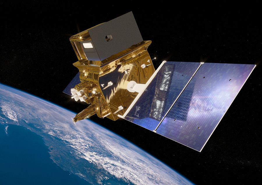
Illustration du satellite Trishna
© CNES/ill./REGY Michel, 2021

Dès lors, le satellite Trishna est un satellite spécialisé dans le domaine de l’infrarouge et de l’observation de la Terre. Il observe les zones végétales et suit les températures des sols. Ainsi, il permet de suivre l’évolution des cultures et de la végétation dans le monde.

L’unité intervient dans la modélisation géométrique des acquisitions envoyées par le satellite.

Pour en savoir plus sur la mission Trishna, visitez le site du CNES dédié à la mission Trishna.

nous contacter observation terre magellium

Les objectifs de Trishna


    Une partie de l’unité est basée dans les locaux du CNES afin de mieux répondre au projet.

    L’objectif du projet Trishna est de comprendre l’évolution locale des phénomènes biologiques (stress hydrique, transpiration), physiques (évaporation, sublimation, zones de panache), climatiques (observation globale sur la durée) en lien avec le cycle de l’eau.

    Mots-clés

    observation, satellite, terre, études, modélisation géométrique, Trishna, CNES, France, ISRO, Inde, capteur thermique

    observation de la terre

    SCIENCE FOR EARTH CARE

    L'unité Observation de la Terre de Magellium est experte en missions spatiales optiques et en applications géophysiques et biophysiques. L'unité offre un haut niveau d'expertise et une complète maîtrise sur l'ensemble de la chaîne de traitement, lui permettant de répondre à tous les projets des plus grandes commandes spatiales telles que l'ESA et le CNES.

    Contact

    eo@magellium.fr

    +33 5 62 24 70 00

    1, rue Ariane
    31520 Ramonville Saint-Agne FRANCE

    Plus d'infos

    www.magellium.com

    Suivez-nous

    FLEX L1B to L2 Retrieval study

    FLEX L1B to L2 Retrieval study

    FLEX L1B to L2 retrieval study

    Development of algorithms and software for L1B to L2D data processing

    flex esa magellium

    Mission

    Mapping of vegetation fluorescence to quantify photosynthetic activity and analysis of fluorescence signals to provide information on photosynthetic efficiency

    Satellites / Instruments

    FLEX satellite, Sentinel

    U

    Skills

    Algorithmic analysis, software development, data processing

    Date

    From 2018 to today

    The FLEX project


    FLEX (FLuorescence EXplorer) is an Earth observation satellite. The mission of the same name is part of ESA’s Living Planet programme.

    The objective of the mission is to carry out global fluorescence measurements in order to better understand the functioning of the photosynthesis process. In short, FLEX will provide a global mapping of vegetation using an onboard imaging spectrometer. This instrument is called FLORIS for Fluorescence Imaging Spectrometer. The mapping should make it possible to quantify photosynthetic activity.

    The objective of the FLEX mission is to analyse the fluorescence signals in order to provide information on the efficiency of photosynthesis. These analyses should improve our knowledge of the carbon stored in plants and its role in the carbon and water cycles. Indeed, fluorescence is a sensitive indicator of photosynthetic disturbance and stress.

    Due to the complexity of the mission, ESA is developing a FLEX L2 End-to-End Mission Performance Simulator tool. Therefore, this tool should be used to :

    reproduce the expected performance of the mission

    verify that the FLORIS mission and instrument concepts meet the system requirements

    analyse the suitability of the developed level 1 and 2 (L2) image processing algorithms

    flex satellite observation terre vegetation magellium

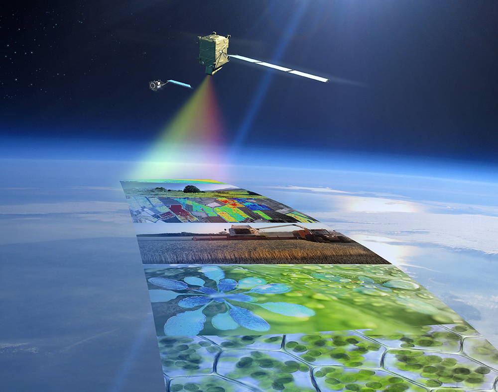
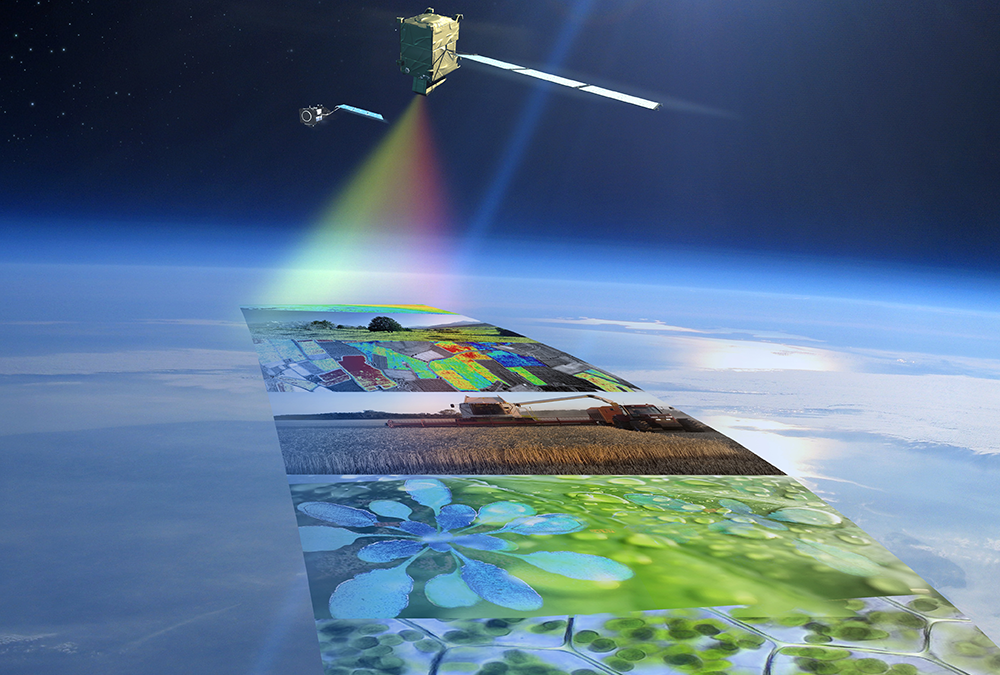
    Illustration of the FLEX satellite

    The EO unit is in charge of algorithm development and performance analysis.

    Find more details on the FLEX website.

    nous contacter observation terre magellium

    The objectives of FLEX

      The objective is to provide scientifically consolidated algorithms (via ATBD) and prototype software for the L1B to L2D data processing modules. These elements will be used for integration into the FLEX L2 End-to-End simulator.


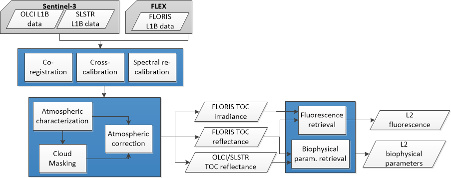
      L2A: radiometric and spectral calibration, geometric co-registration

      L2B: atmospheric characterisation, cloud detection, atmospheric correction

      L2C: fluorescence recovery

      L2D : biophysical parameters recovery

      flex satellite observation terre vegetation magellium

      Key partners

      ESA, Universitat de Valencia, Universita de Milano, Universita di Bologna, Finnish Meteorological Institute

      Key words

      observation, satellite, earth, studies, fluorescence, spectrometer, algorithm, software, FLEX, vegetation, radiometry, geometry, sensor, carbon, water, photosynthesis, mapping, ESA

      observation de la terre

      SCIENCE FOR EARTH CARE

      The Earth Observation Unit of Magellium  is an expert in optical space missions and geophysical and biophysical applications. The EO unit provides high level of expertise and full capacity on the whole processing chain, enabling it to respond to all projects from the greatest space orders such as ESA and CNES.

      Contact

      eo@magellium.fr

      +33 5 62 24 70 00

      1, rue Ariane
      31520 Ramonville Saint-Agne FRANCE

      More info

      www.magellium.com

      Follow us

      DSMGenerator

      DSMGenerator

      DSMGenerator

      Automatic generation of Digital Surface Models

      Product

      Automatic generation of digital surface models from high resolution multi-stereoscopic acquisitions

      Satellites / Instruments

      Stereoscopic satellite products, such as Pleiades

      U

      Skills

      Sensor geometry, multi-stereoscopy, multi-threading

      Date

      From 2018 to today

      The ready-to-use product DSMGenerator


        DSMGenerator (Digital Surface Model Generator) is a tool for automatic generation of digital surface models from high-resolution multi-stereoscopic acquisitions. Acquisitions come from satellites such as Pleiades.

        The DSMGenerator tool is designed to make the most of parallel computing. Indeed, this is made possible by multithreading and careful management of memory consumption.

        Production follows defined steps. First, for each pair of images, we perform a projection in epipolar geometry using Euclidium and a cutting of the tiles. Then, for each pair of tiles, we perform a disparity map calculation using the OpenCV SGMB implementation. We also perform a conversion of the disparity map into a point cloud. Finally, we merge all the point clouds and produce the final DSM.

        dsm generator magellium

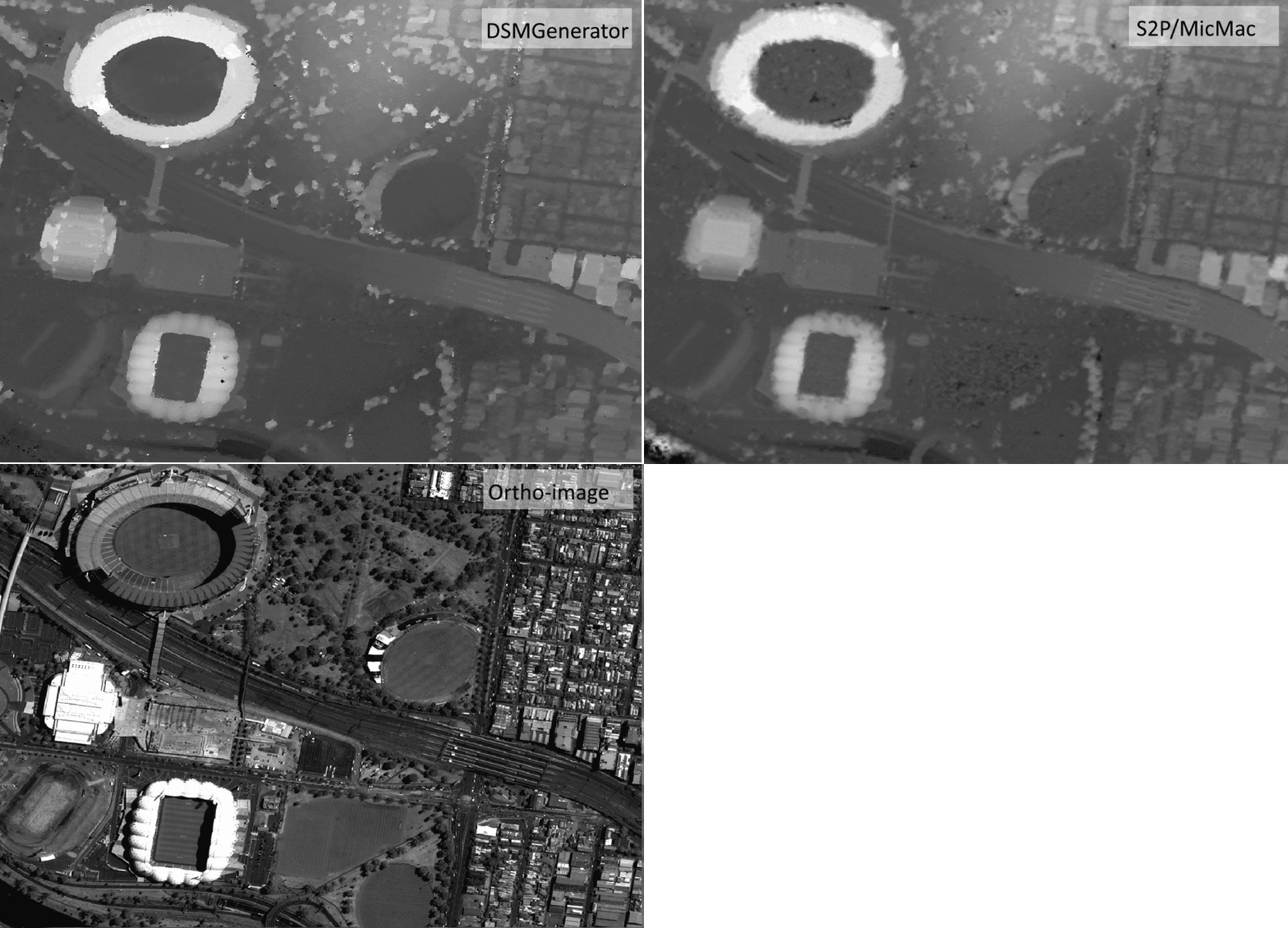
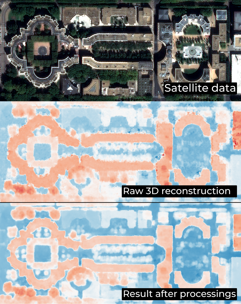
        Comparison of a DSM generated by DSMGenerator from a Pleiades stereo triplet and a DSM generated by other methods from the same inputs.

        The EO unit tested the product on Pleiades HR 3-stereo, Pleiades HR 13-stereo and ZY3-2-stereo. In conclusion, it took less than an hour to process the Pleiades HR 3-stereo data on a 12-core server.

        The DSMGenerator tool is also used for the 3D reconstruction.

        nous contacter observation terre magellium

        Product features


        Multi-sensor genericity

        Physical or rpc modelling of the line of sight

        Multi-stereo, from 2 to n-tuplet

        Production of intermediate clouds

        Production of a final 2.5D digital surface model at the resolution of the original image

        Parallel, scalable, cloud-ready computing

        Key words

        satellite, digital surface model, DSM, pleiade, geometry, point cloud, stereo

        observation de la terre

        SCIENCE FOR EARTH CARE

        The Earth Observation Unit of Magellium  is an expert in optical space missions and geophysical and biophysical applications. The EO unit provides high level of expertise and full capacity on the whole processing chain, enabling it to respond to all projects from the greatest space orders such as ESA and CNES.

        Contact

        eo@magellium.fr

        +33 5 62 24 70 00

        1, rue Ariane
        31520 Ramonville Saint-Agne FRANCE

        More info

        www.magellium.com

        Follow us

        3D reconstruction

        3D reconstruction

        3D reconstruction

        3D reconstruction of urban areas

        Mission

        Conduct a series of studies to build a 3D representation of urban areas

        Instruments

        Pleiades

        U

        Skills

        Sensor geometry, deep learning, 3D reconstruction

        Date

        From 2020 to today

        The 3D reconstruction project


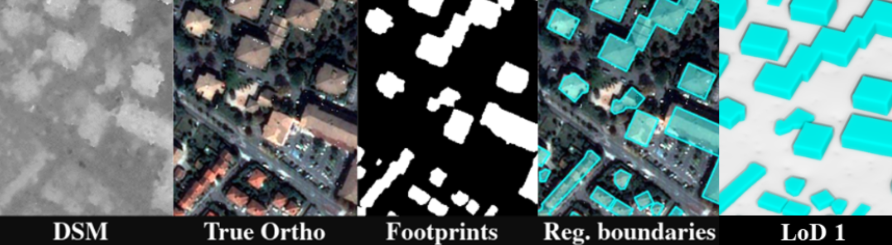
        Thanks to CNES contracts and our own investments, we are conducting a series of studies to build a 3D representation of urban areas. These 3D reconstructions are based on multi-stereo images such as Pleiades (50cm spatial resolution).

        3d reconstruction magellium pleiades

        The phases of a 3D reconstruction


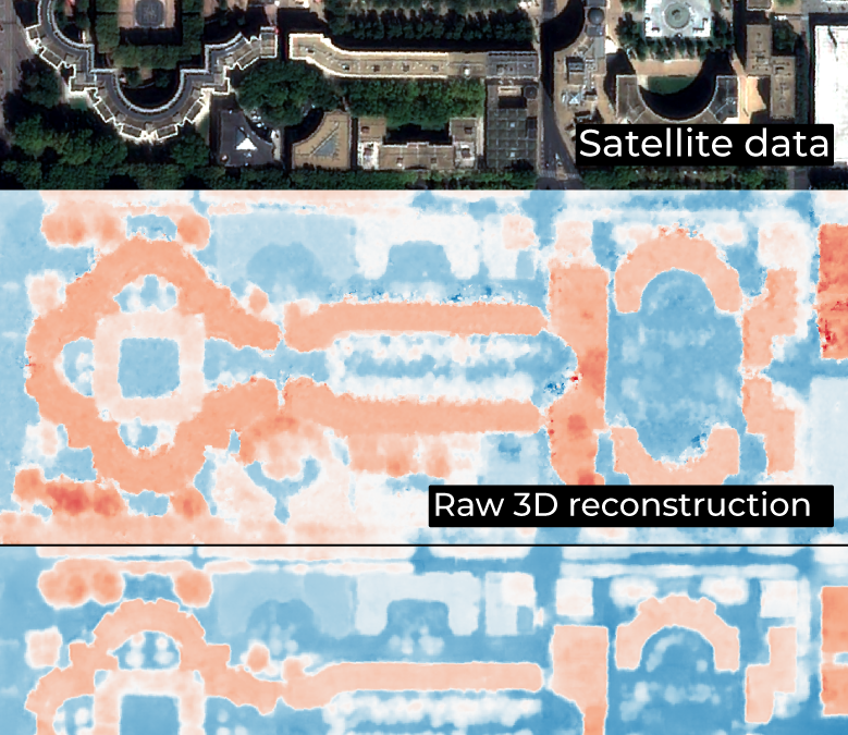
        • 3D reconstruction of the DSM from multi-stereo images (by stereo-correlation)


        • MNS improvement (by deep learning)


        • detection of building footprints (deep learning)


        • segmentation of roof slopes (deep learning)


        • construction of LOD2 building models
        digital surface monitoring observation terre donnees satellite

        Key partner

        CNES

        Key words

        digital surface modelling, DSM, deep learning, Pleiades, sensor geometry, reconstruction, 3D, images, multi-stereo, areas, urban

        observation de la terre

        SCIENCE FOR EARTH CARE

        The Earth Observation Unit of Magellium  is an expert in optical space missions and geophysical and biophysical applications. The EO unit provides high level of expertise and full capacity on the whole processing chain, enabling it to respond to all projects from the greatest space orders such as ESA and CNES.

        Contact

        eo@magellium.fr

        +33 5 62 24 70 00

        1, rue Ariane
        31520 Ramonville Saint-Agne FRANCE

        More info

        www.magellium.com

        Follow us

        MicroCarb

        MicroCarb

        MicroCarb

        Technical support for CNES

        cnes centre national etudes spatiales observation terre

        Mission

        Measuring global carbon dioxide concentration and improving understanding of the carbon cycle and climate

        Instruments

        Passive 4-band NIR and SWIR array spectrometer

        U

        Skills

        Cloud detection, performance studies, radiometry, geometry, simulator development

        Date

        From 2015 to today

        The MicroCarb project


        The MicroCarb mission allows the study of atmospheric CO2 on a global scale. Indeed, CO2 is the main greenhouse gas. Today we do not know how much CO2 is absorbed or emitted in certain regions of the Earth. This is mainly due to the fact that we lack ground-based measuring stations. It is therefore necessary to map the sources and sinks of this gas in order to better understand the origins and impacts of climate change. Indeed, CO2 remains the main greenhouse gas produced by human activities.

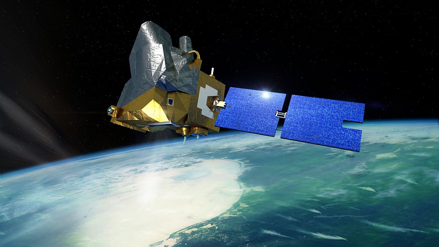
        The MicroCarb satellite will be able to measure the atmospheric concentration of CO2 over the entire planet. These highly accurate measurements will be possible thanks to a passive array spectrometer in 4 NIR and SWIR bands. These elements will also improve the understanding of the carbon cycle and climate.

        nous contacter observation terre magellium

        microcarb cnes magellium

        Illustration of the MicroCarb satellite
        © CNES/ill./SATTLER Oliver, 2021

        The unit is in charge of measuring the global concentration of carbon dioxide as a technical support to CNES.

        Find out more about the MicroCarb project here.

        The objectives of Microcarb


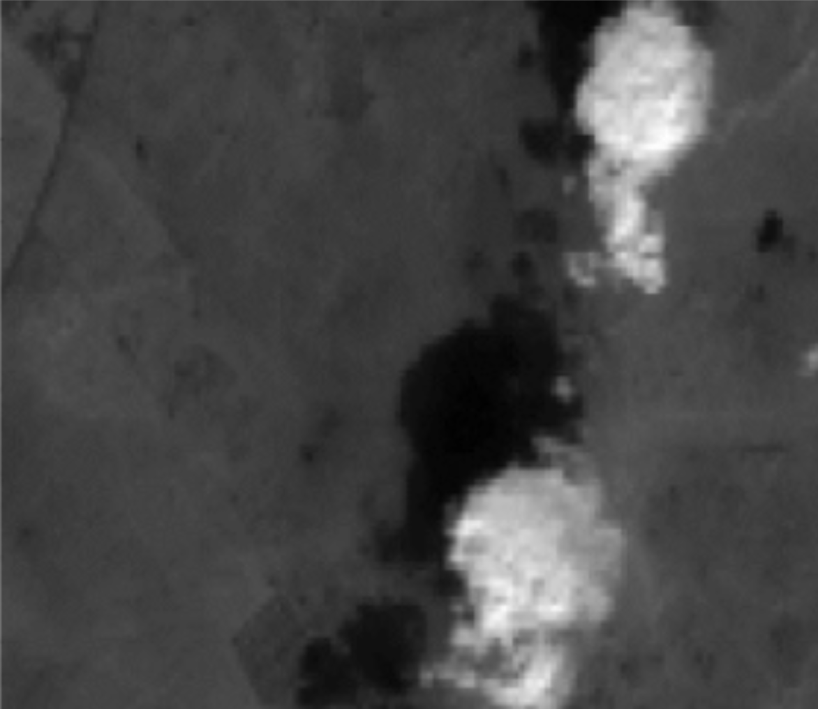
        Cloud detection

        by imaging

        by radiative transfer


        Performance studies

        Impact of instrumental defects (radiometric, spectral, geometric, residual polarisation)

        Realistic calculation of the SRIF


        Development of an orbital performance simulator

        microcarb cnes magellium

        Can shadows help in cloud detection?
        Simulation of the S2 MicroCarb imager

        Key partner

        CNES

        Key words

        observation, satellite, earth, studies, climate change, warming, cnes, carbon dioxide, ground segment, cloud detection, microcarb

        observation de la terre

        SCIENCE FOR EARTH CARE

        The Earth Observation Unit of Magellium  is an expert in optical space missions and geophysical and biophysical applications. The EO unit provides high level of expertise and full capacity on the whole processing chain, enabling it to respond to all projects from the greatest space orders such as ESA and CNES.

        Contact

        eo@magellium.fr

        +33 5 62 24 70 00

        1, rue Ariane
        31520 Ramonville Saint-Agne FRANCE

        More info

        www.magellium.com

        Follow us